Last year I tried to ride across the state on the Palouse to Cascades trail with my brother. Due to mechanical issues we only kind of made it to the Columbia. A few weeks ago I set out to do it completely.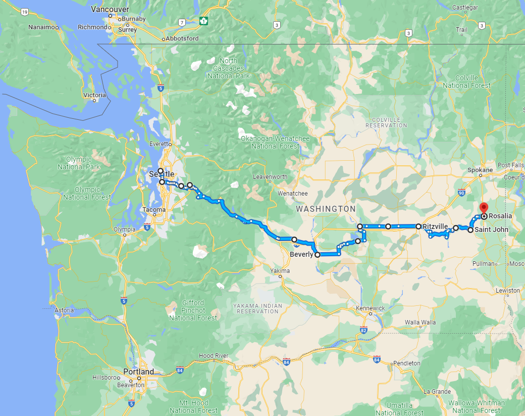
This is from the 2021 attempt, but I thought it a pretty great picture so I'm including it here. Leaving Tolt-MacDonald campground in the morning, following the Snoqualmie Valley Trail.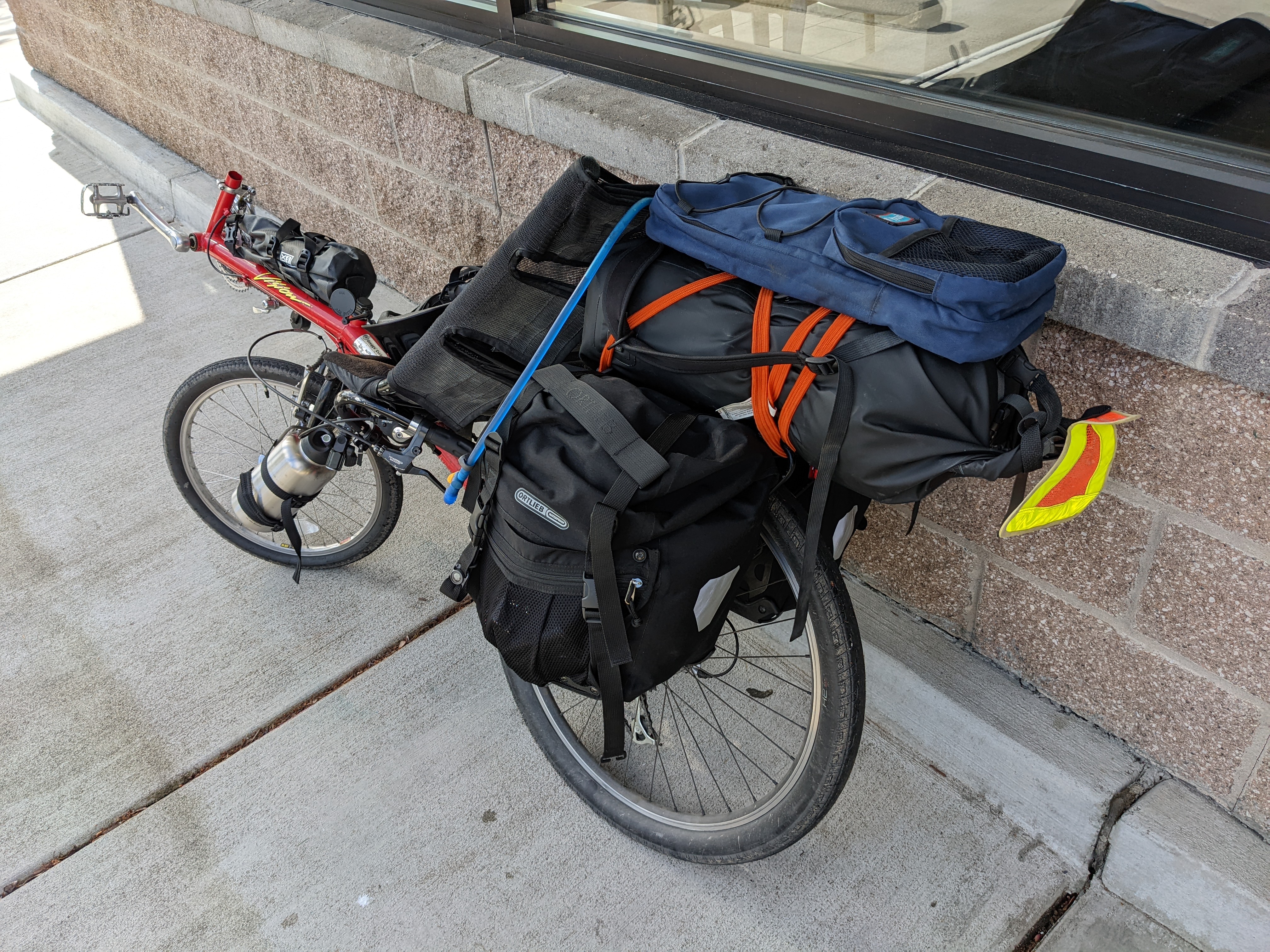
One of the big lessons from the first attempt was that I needed a better packing system for my recumbent, as there was just too much weight on the rear rack. This is what I ended up with. Two 32oz water bottles on the front fork, and a caged bag between my legs on the frame, mostly containing tools and spare inner tubes. My two Ortleib paniers on the rear rack, with a 30 liter dry bag strapped on top with the tent and sleeping bag. And 2 liters of camelback on the very top. Still pretty heavy, but I invested in some better rain and cold weather gear to help keep the bulk down at least.
I've never been good at following directions.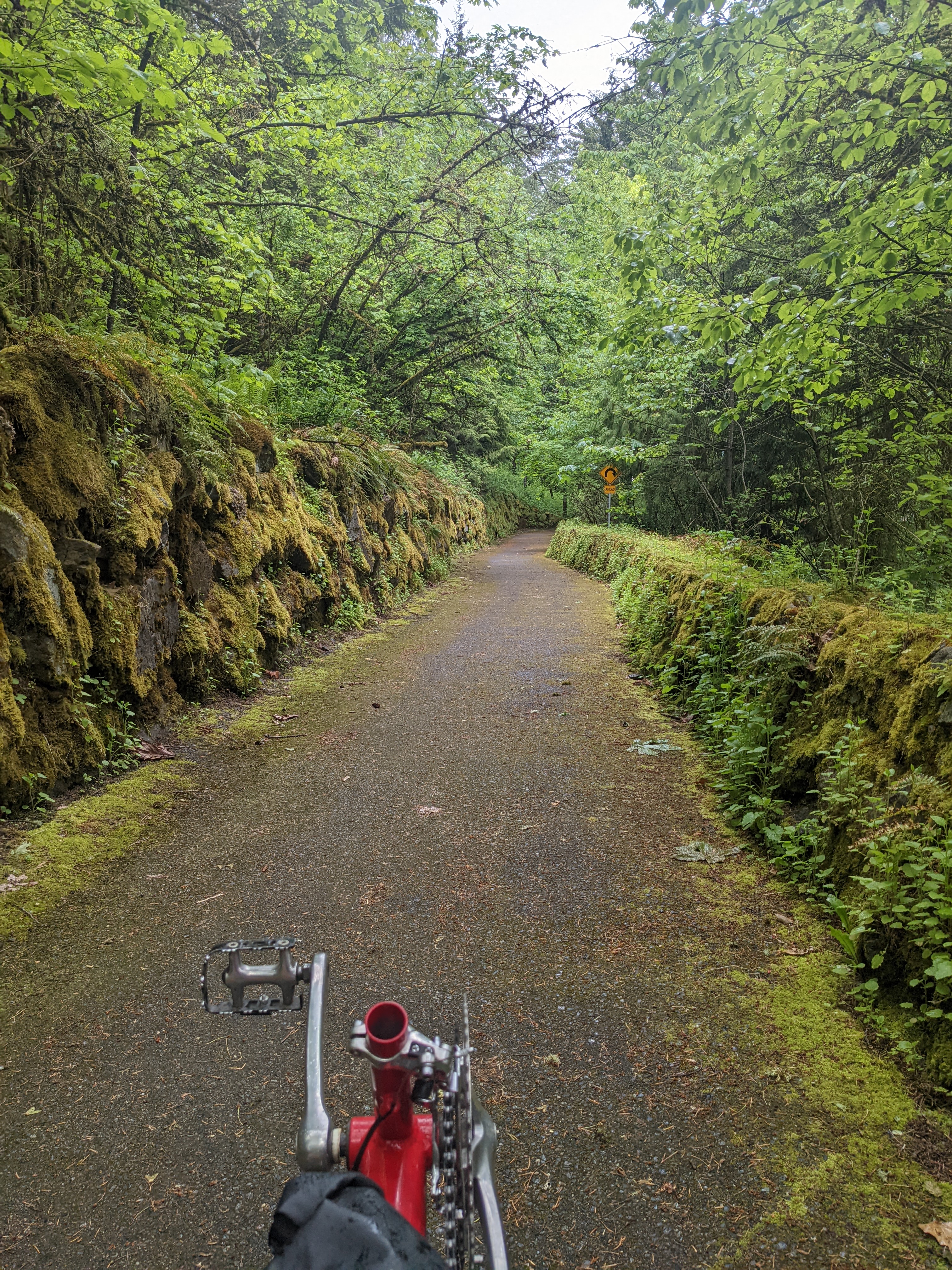
This time I headed straight for the PTC, getting as far as North Bend on the first day. Sadly there isn't complete rail right of way all the way up, and both times 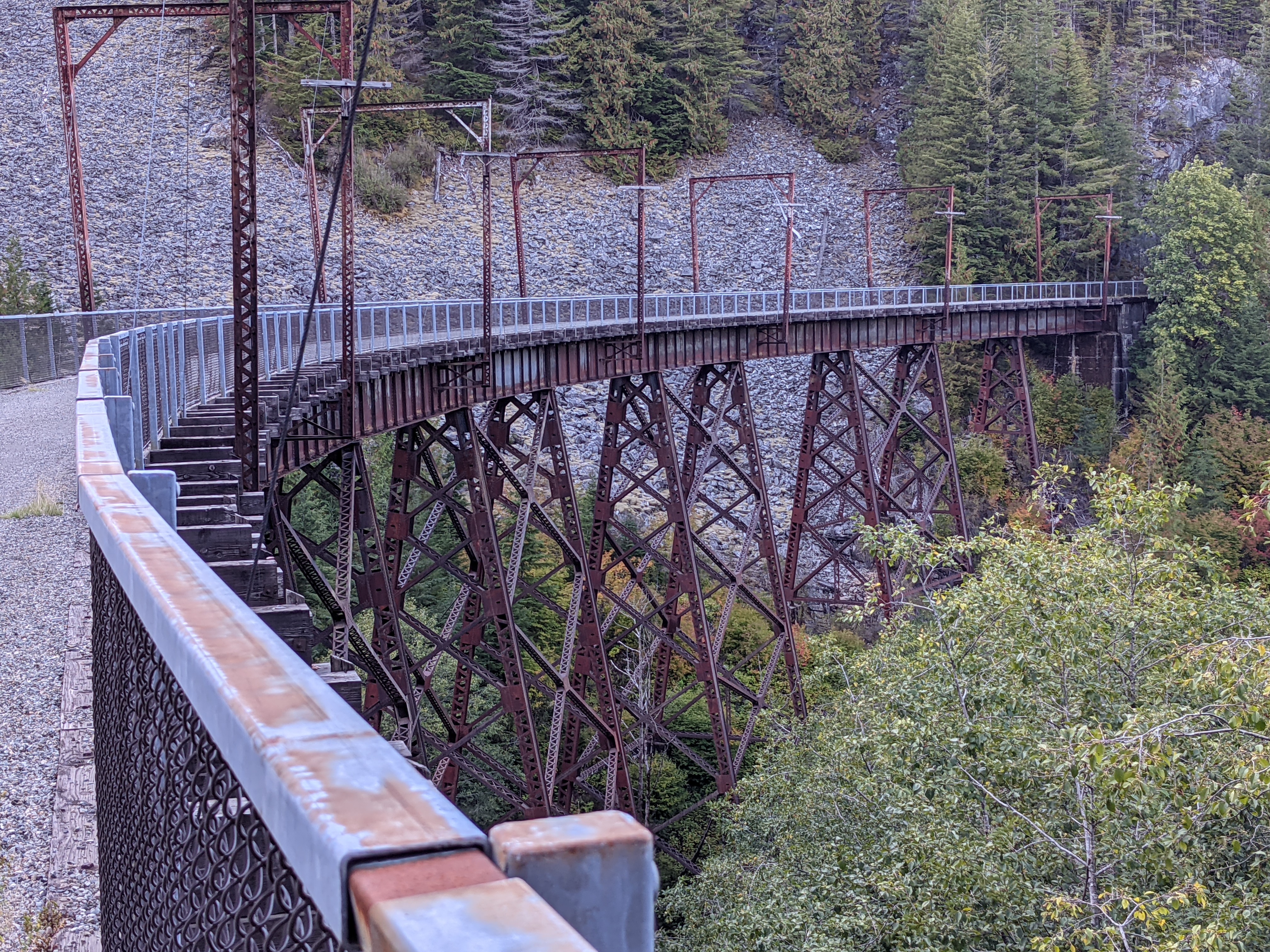
This was originally the Milwaukee Road, built at the beginning of the 20th century. And it was electrified! They tore that out in the 60s, of course, since diesel was cheap, and then the whole thing folded in 1980.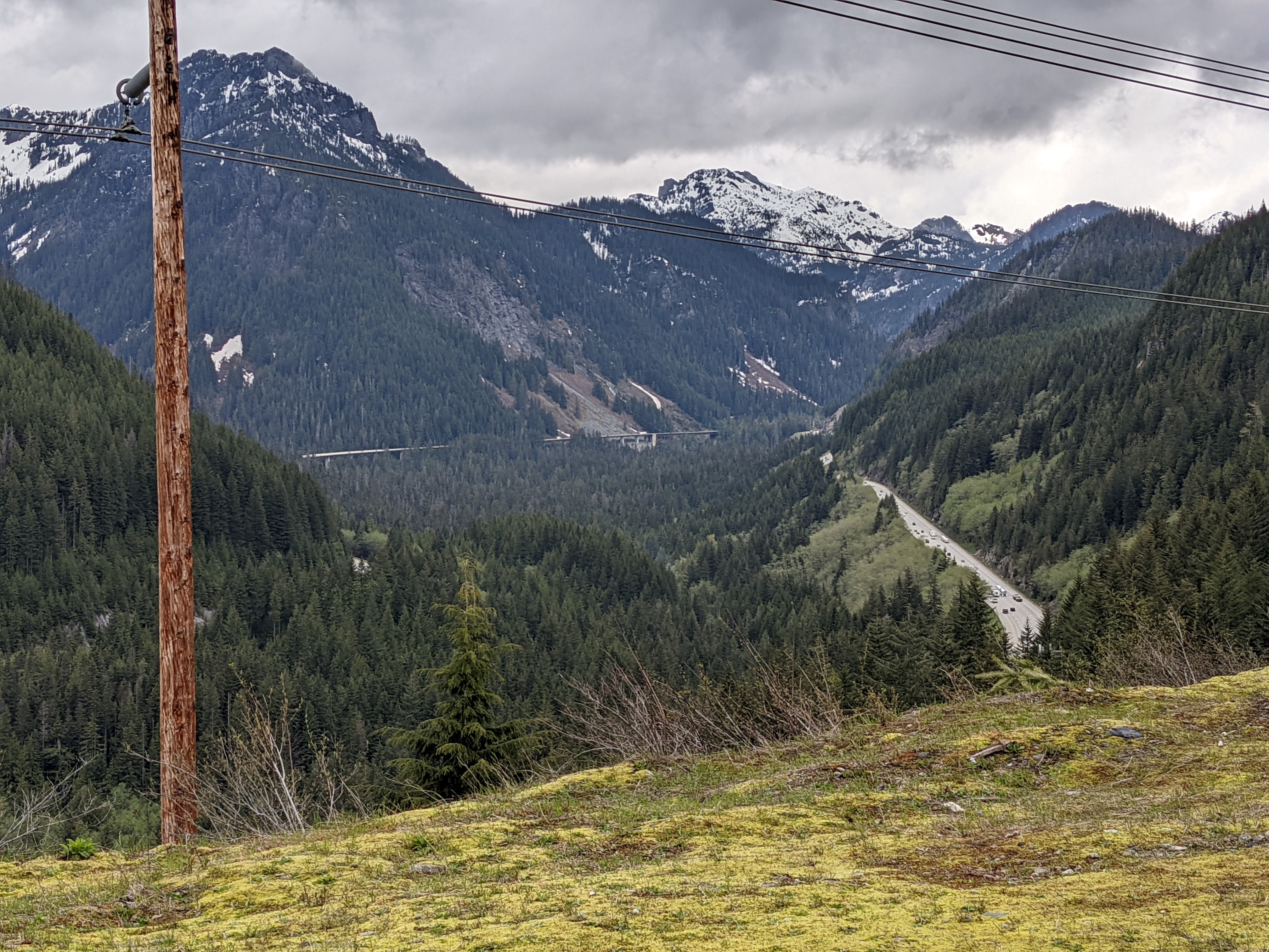
That's I-90 down there, seen from the trail just before it goes under the mountain.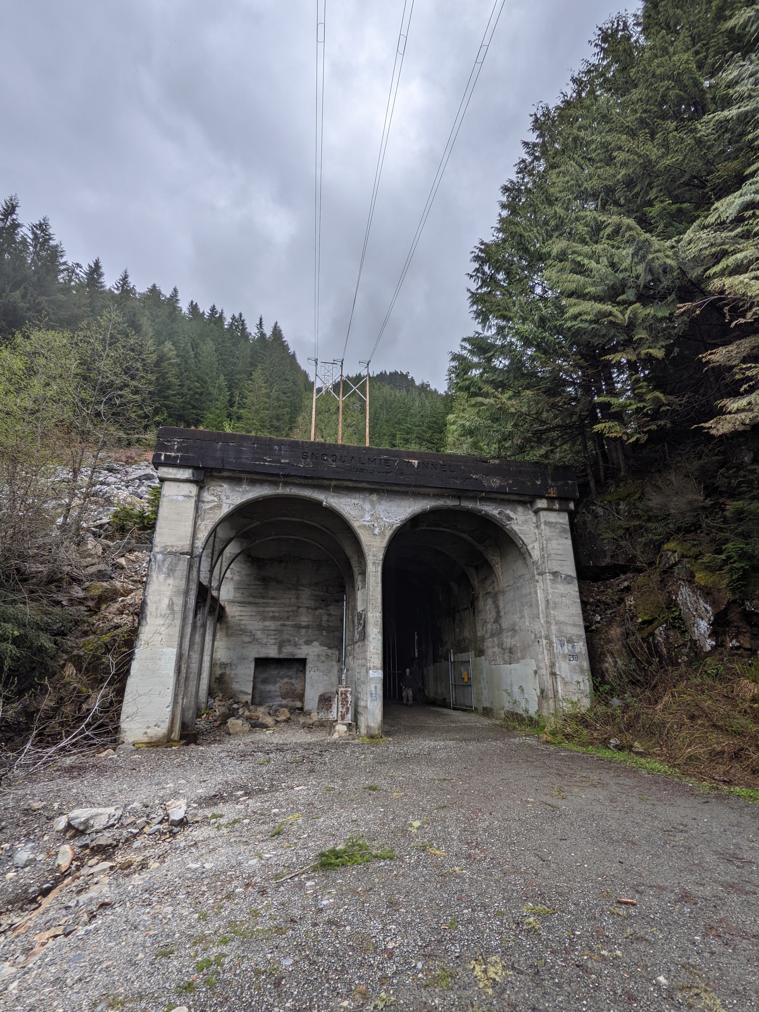
This is how you get under the mountain. 3.6 kilometers of very cold drips. Definitely bring a good light for this section!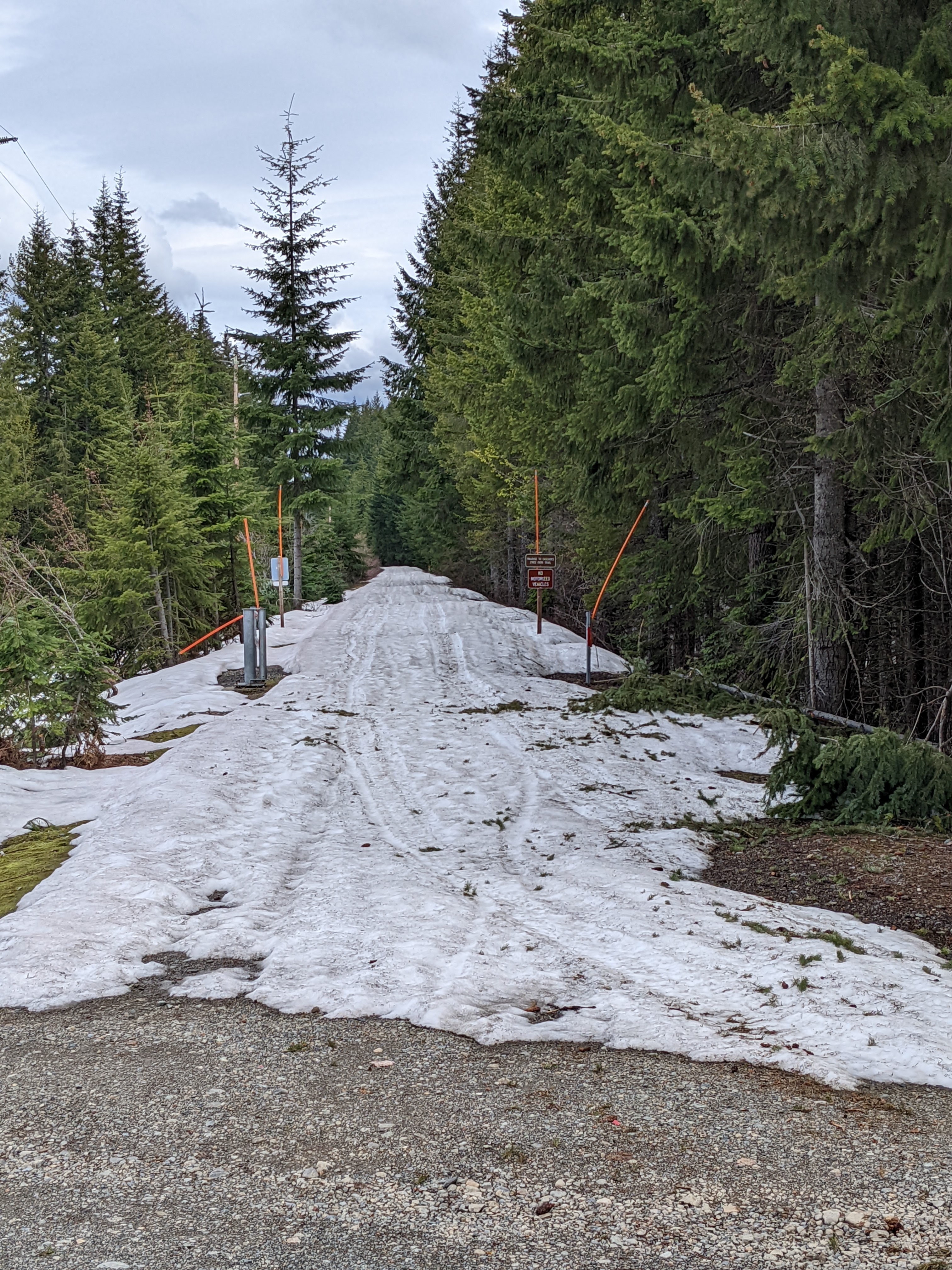
I wasn't expecting snow. At first it was manageable, along the Lake Keechelus section where the trail got plenty of sunlight. But past there it looked like it could go on for miles. So I noped on over to I-90 and skipped the next 20 km. First time I've ever riden on a freeway! Honestly, while loud and intense, the super wide shoulders felt way safer than a lot of county highway riding I've done. I even got to zoom past a bunch of traffic at one point.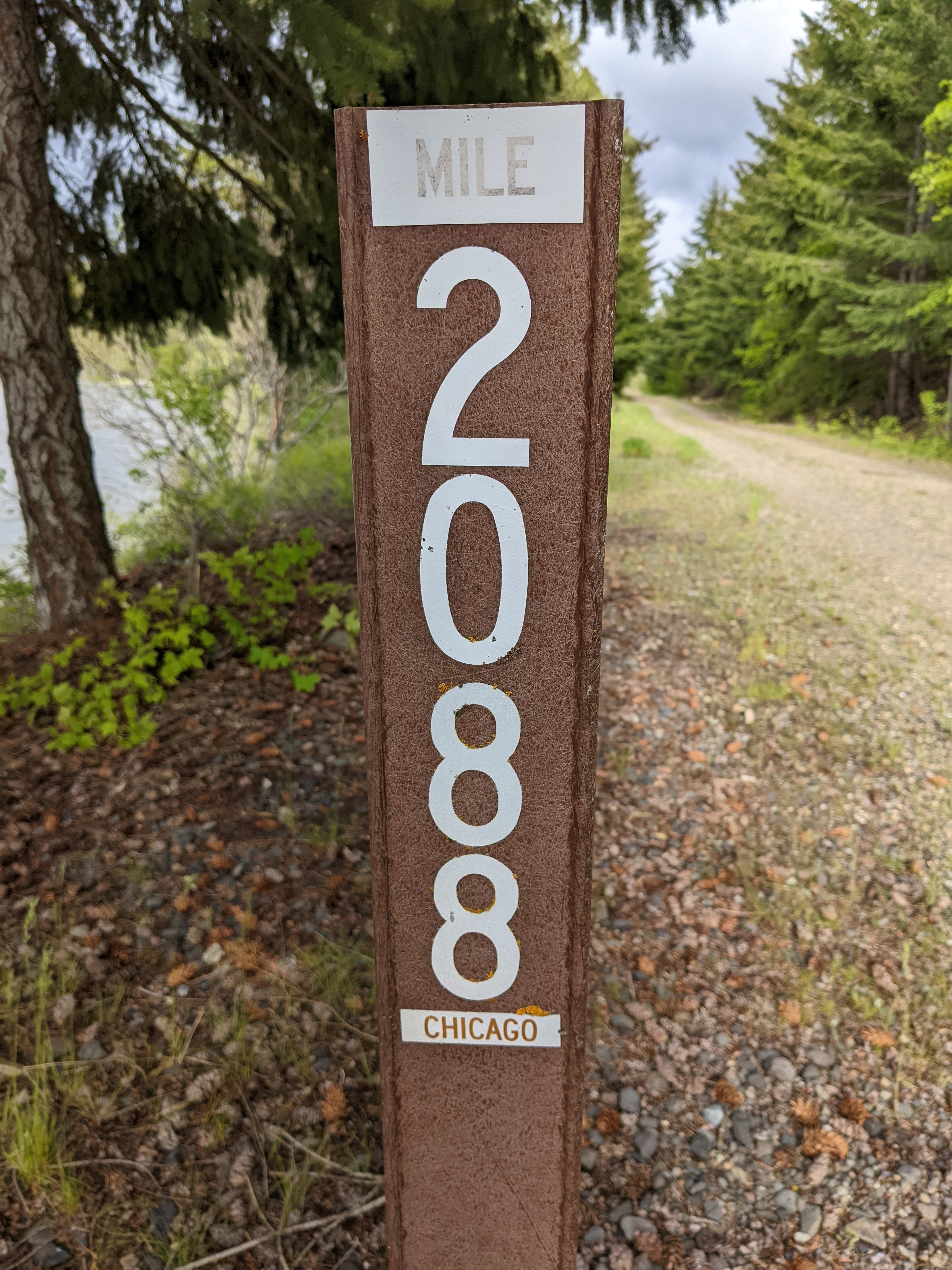
Luckily I wasn't going quite this far.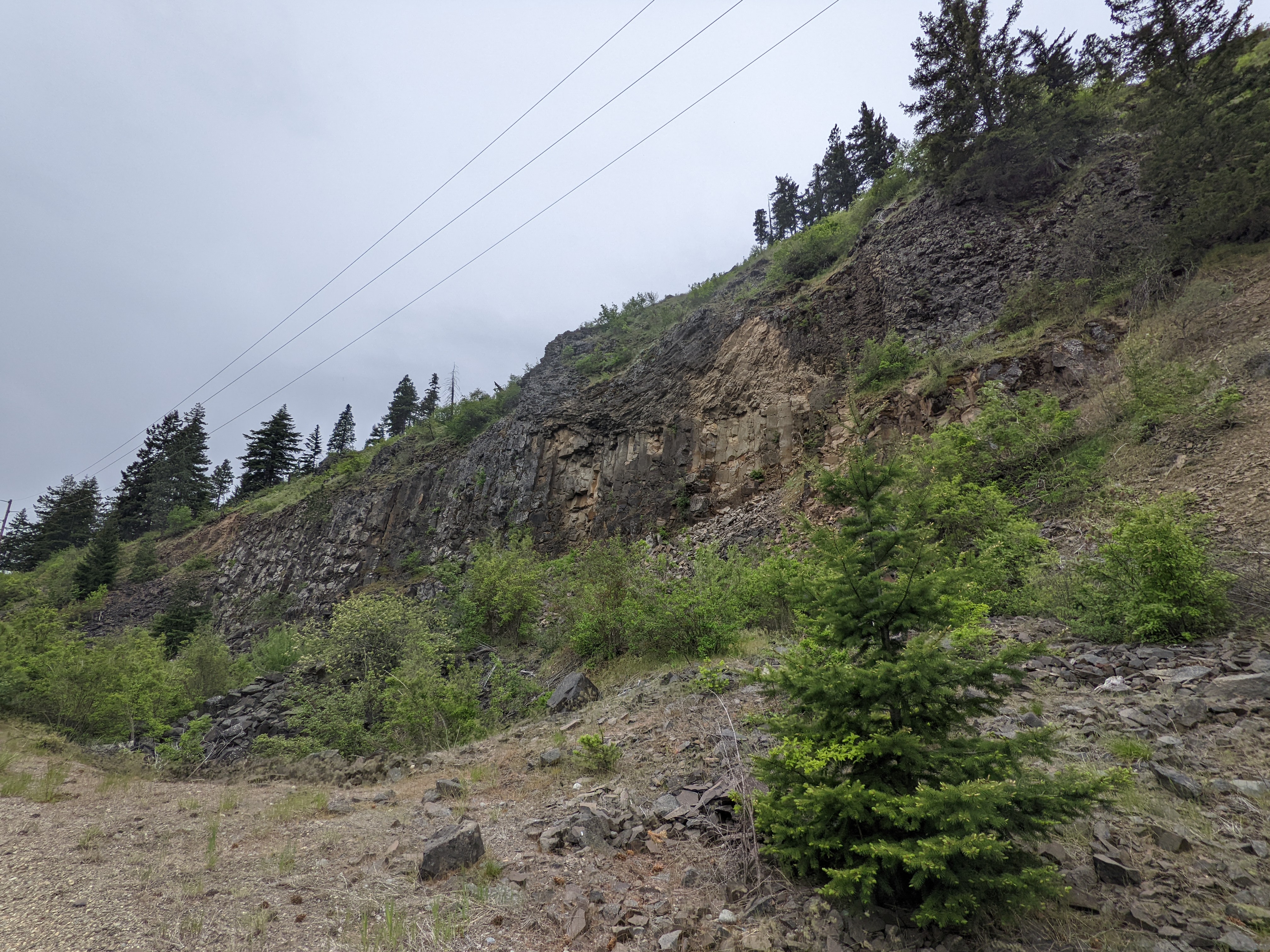
Over the mountains, I got to my favorite bedrock -- flood basalts! For the rest of the trip, I'd be riding over 1-2 miles of the stuff. My state has the best geology.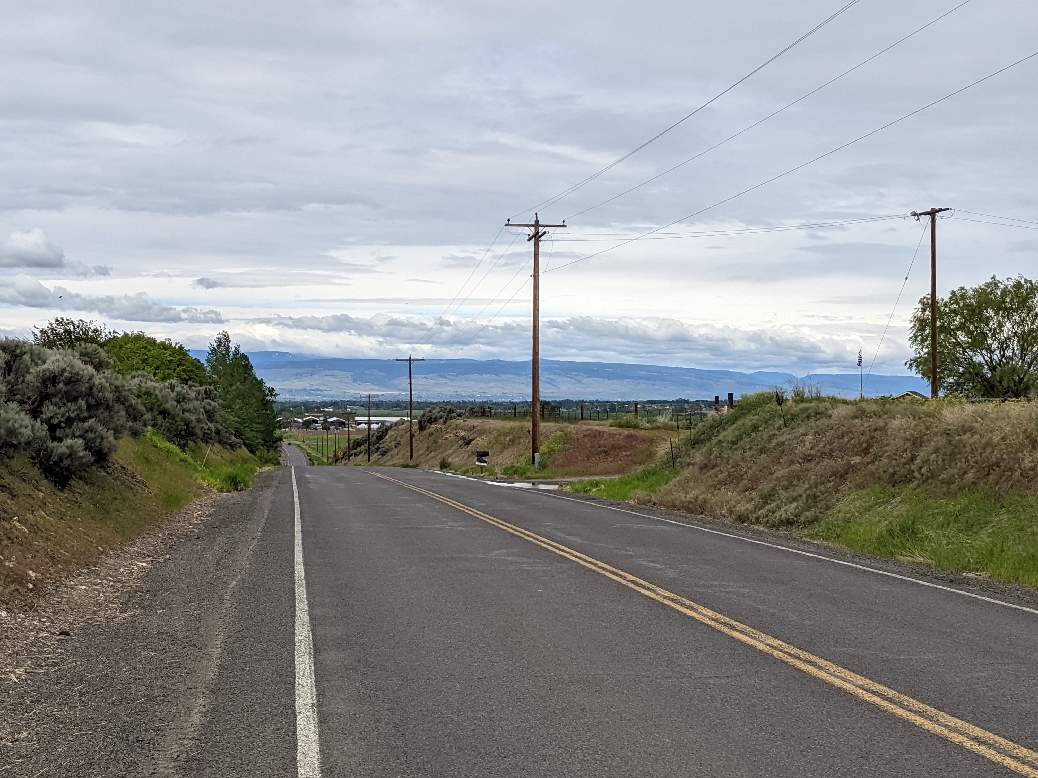
Past Ellensburg, I decided to take the Old Vantage highway down to the Columbia, since I had already done that rather challenging trail section.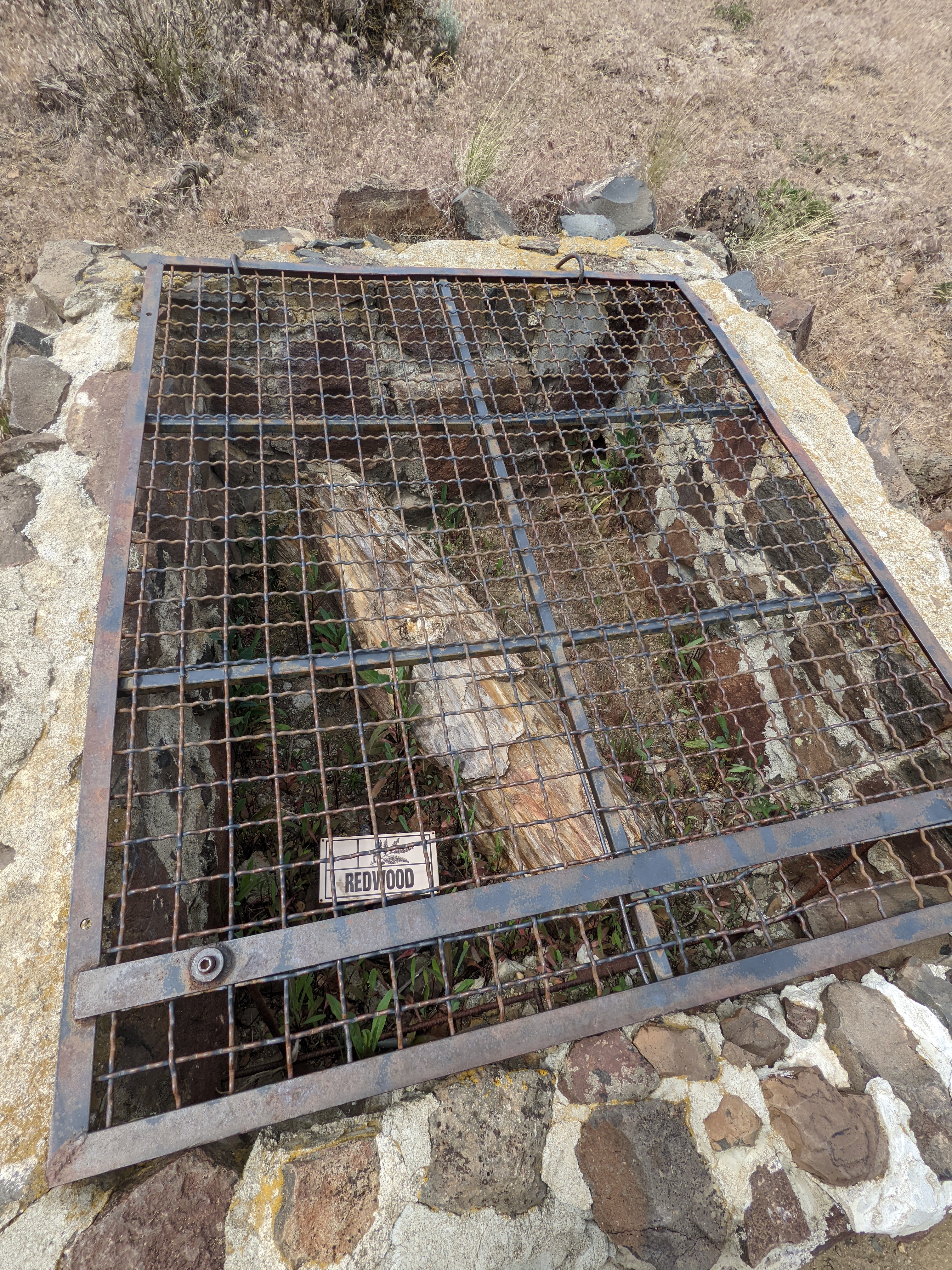
You can see some petrified wood along the way, imprisoned for its great crimes. These actually show up in a layer of the flood basalt! There was some kind of giant lake here, 16 million years ago, clogged with the waterlogged trunks of a surprising variety of tree species from many different biomes. (Brought in by flooding? Lahars? It's an open question.) Then the lava came, prevented by the water from completely burning them up. This sealed them away, creating the perfect conditions for petrification.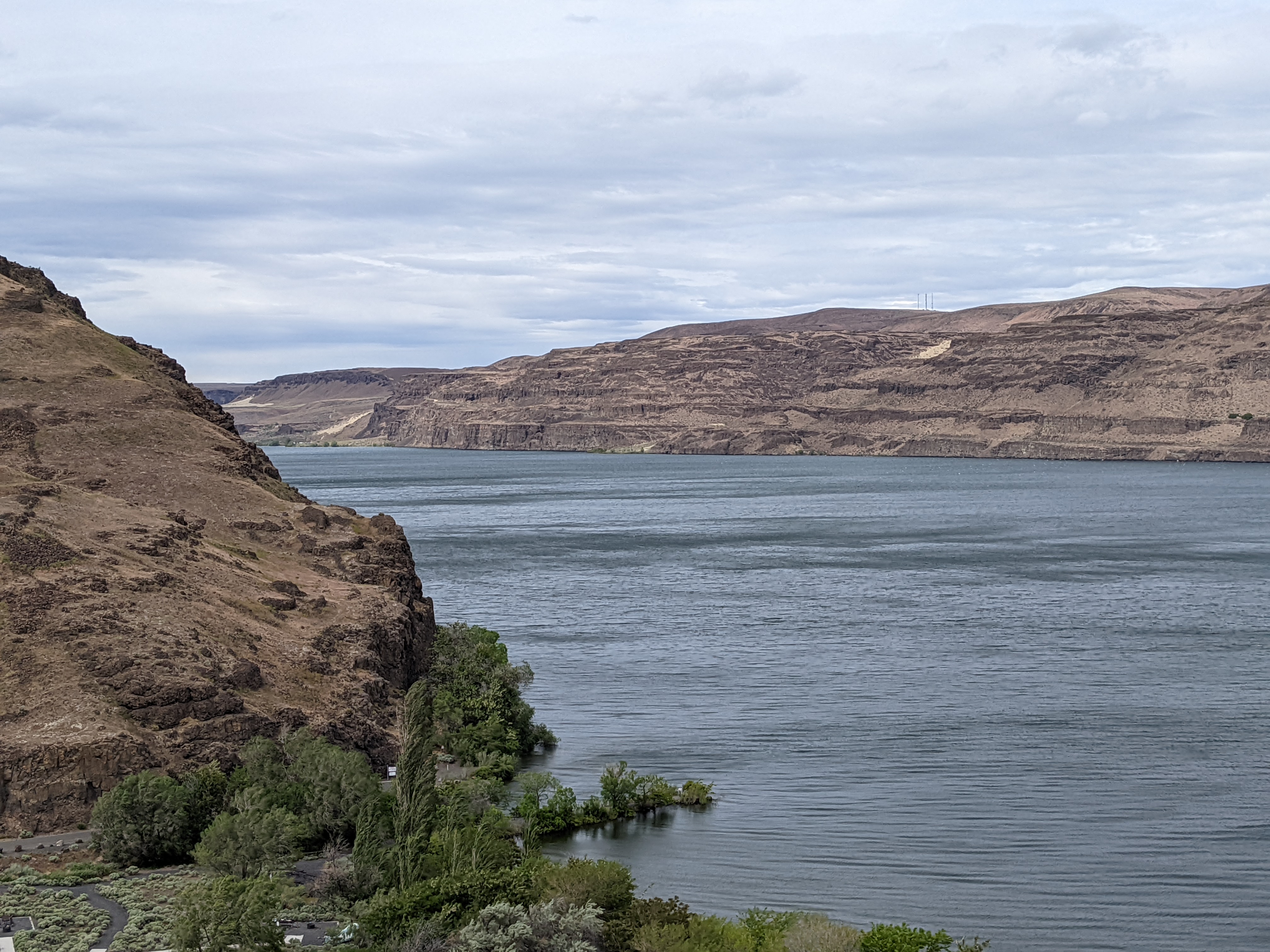
The Columbia! Technically it's a lake here, but whatever. You can see just a few of the three hundred basalt layers along its banks.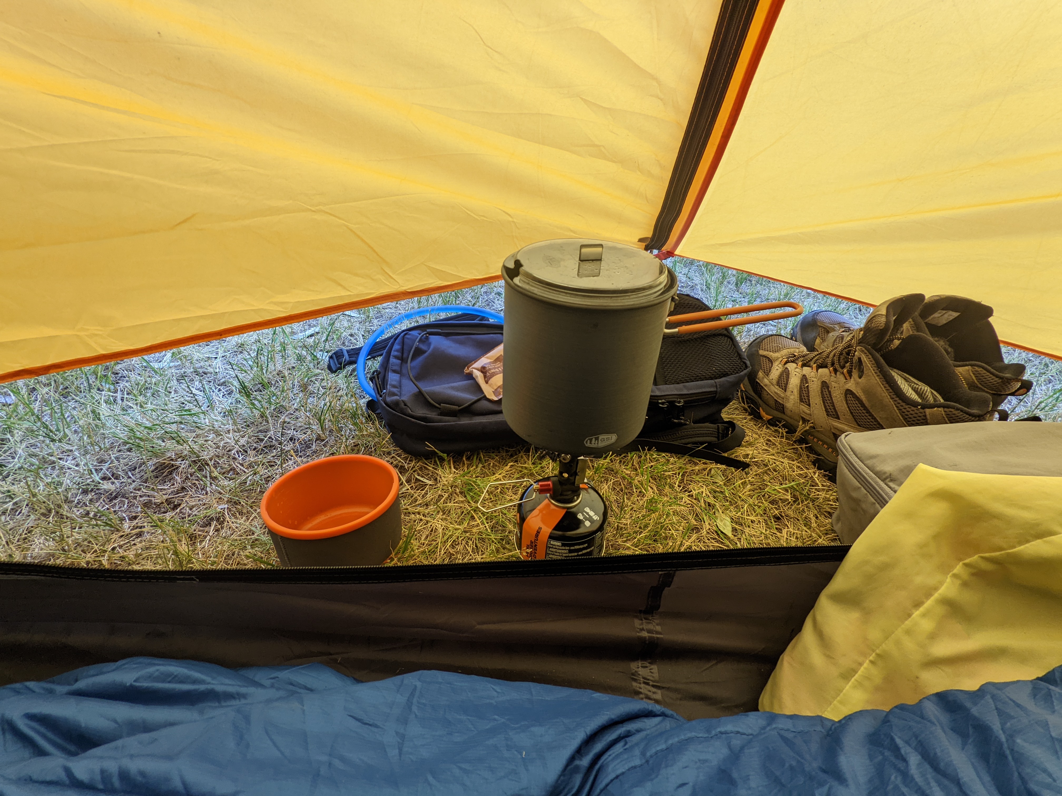
Camping at Wanapum Park in the gorge was a bit challenging, as the wind was absolutely relentless the whole time. I had to cook breakfast inside the tent, so the pot wouldn't get blown over.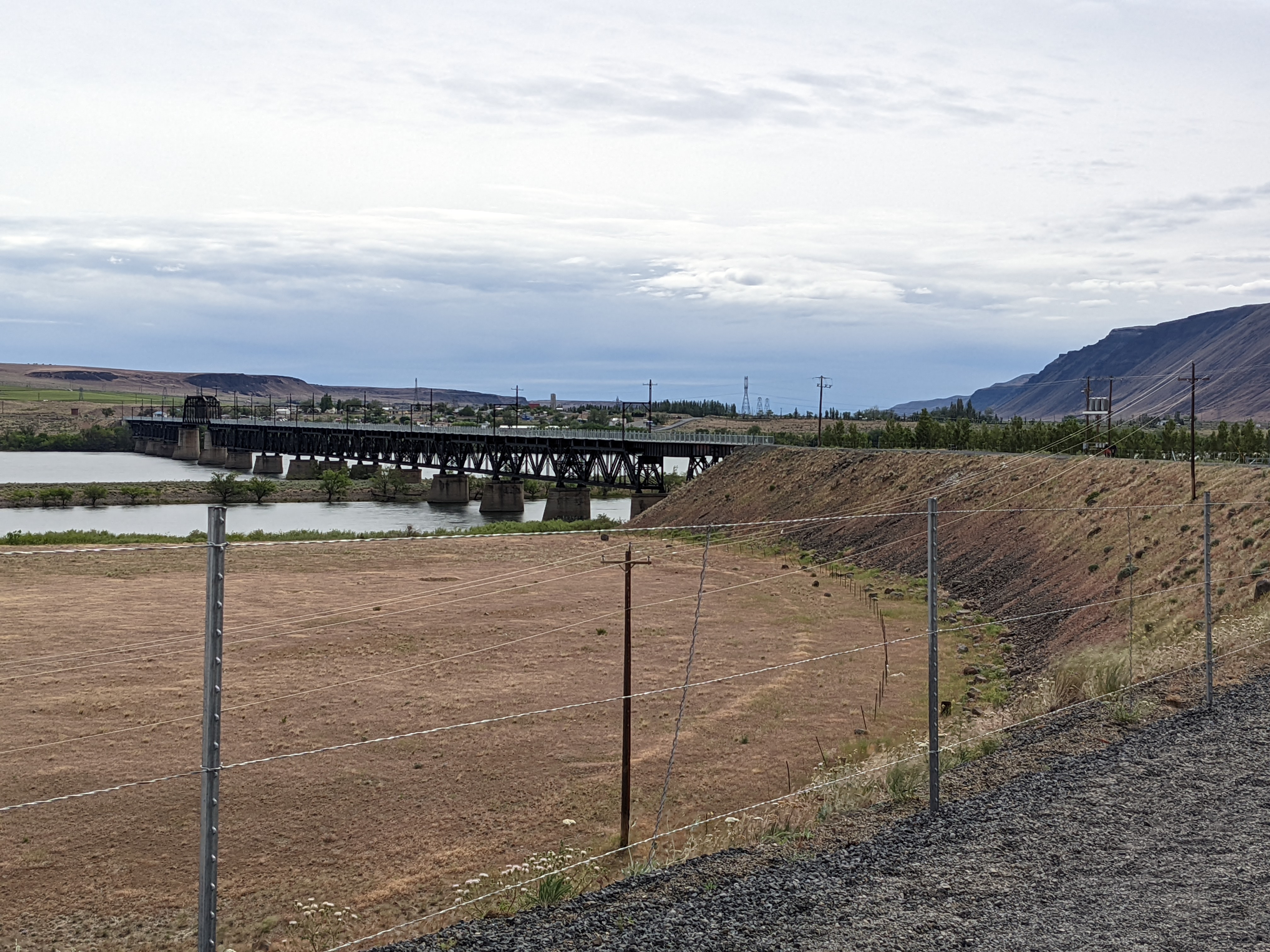
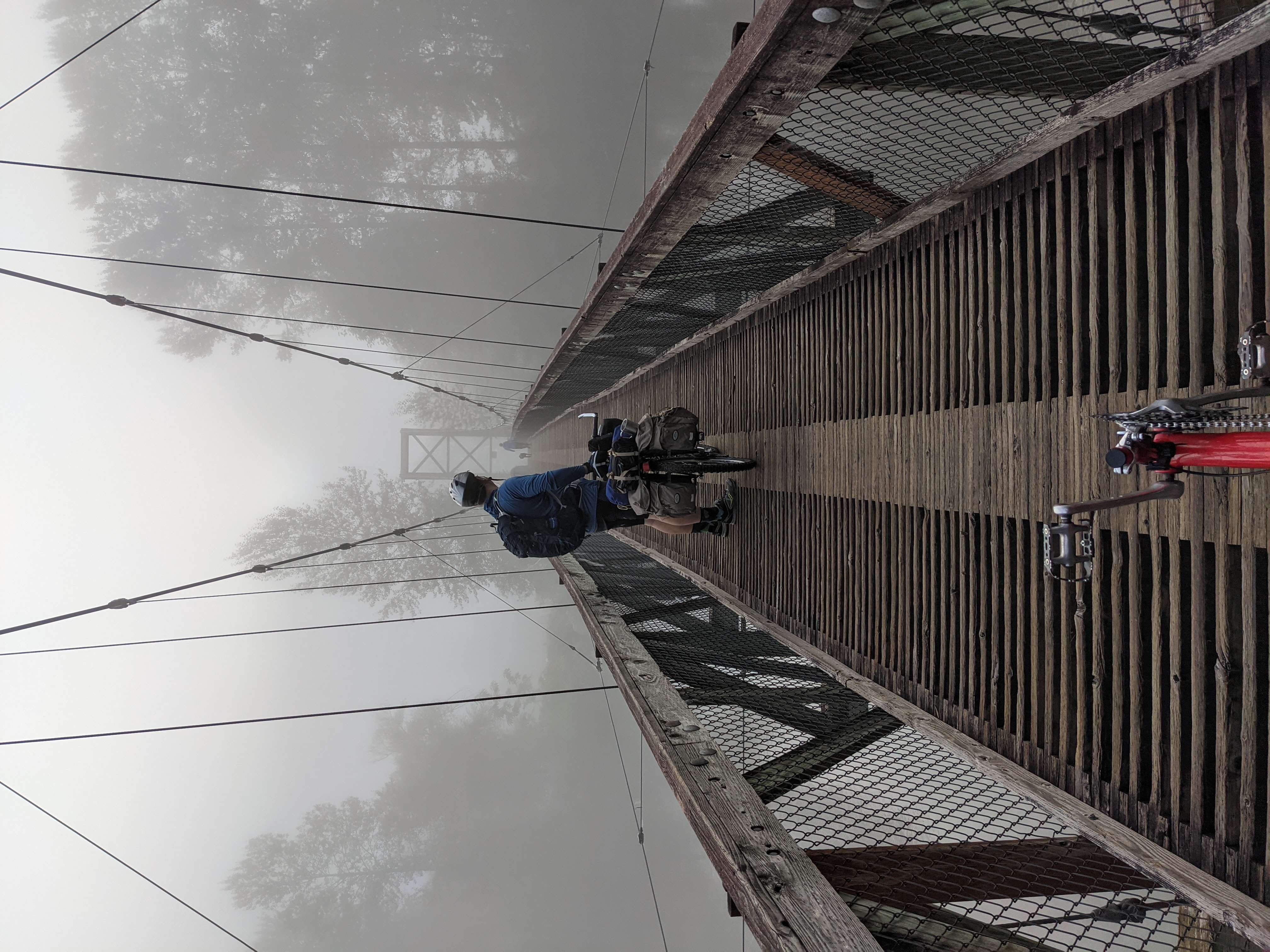
This was the farthest we got on the first attempt -- the Beverly Bridge. A big retrofit for ped/bike use only just finished after it was partially burned down about 10 years ago. I was really looking forward to getting to cross it, as it's a pretty amazing bit of infrastructure investment. Without it, the only options for crossing the river were all quite terrible.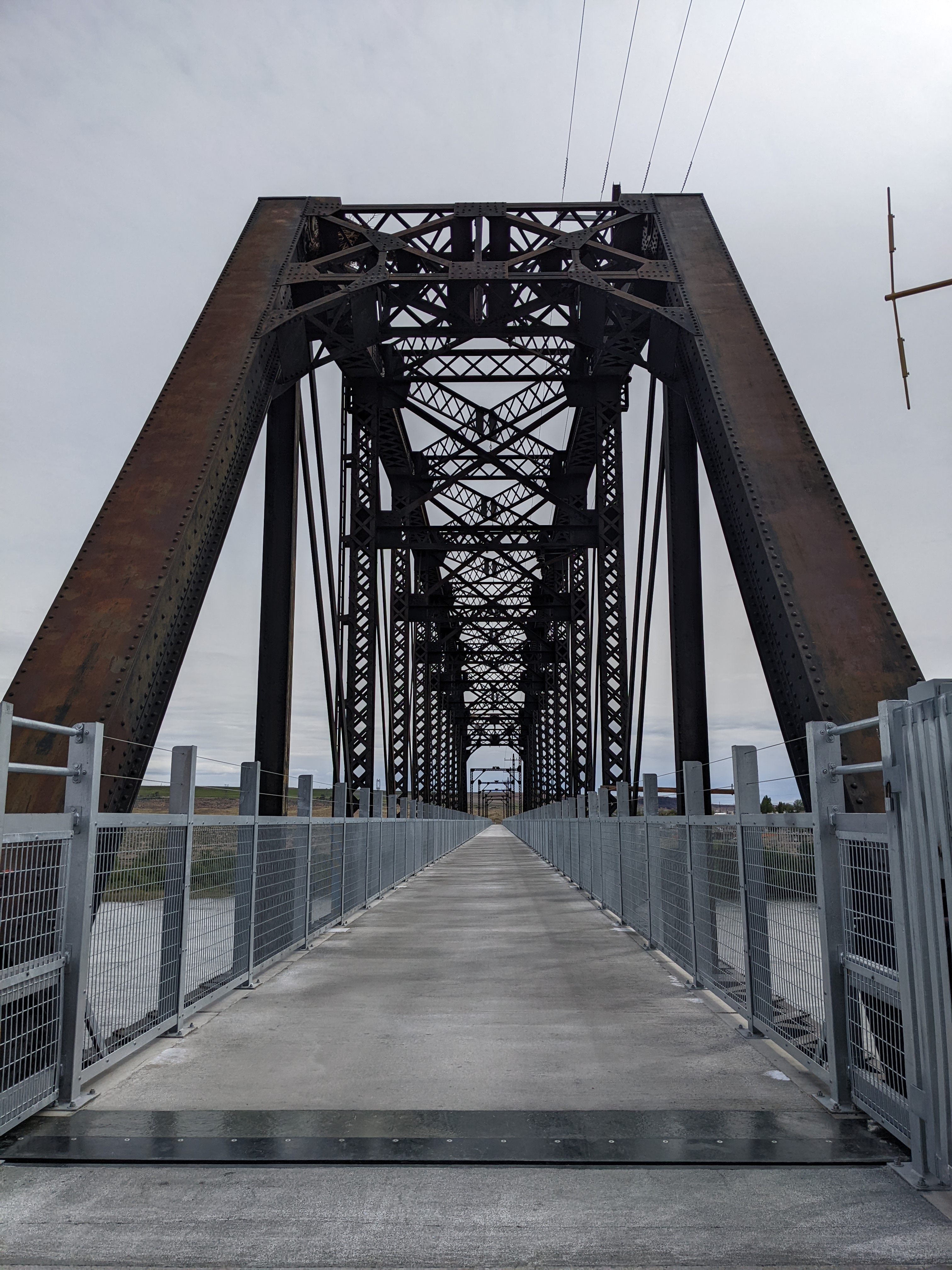
BRIDGE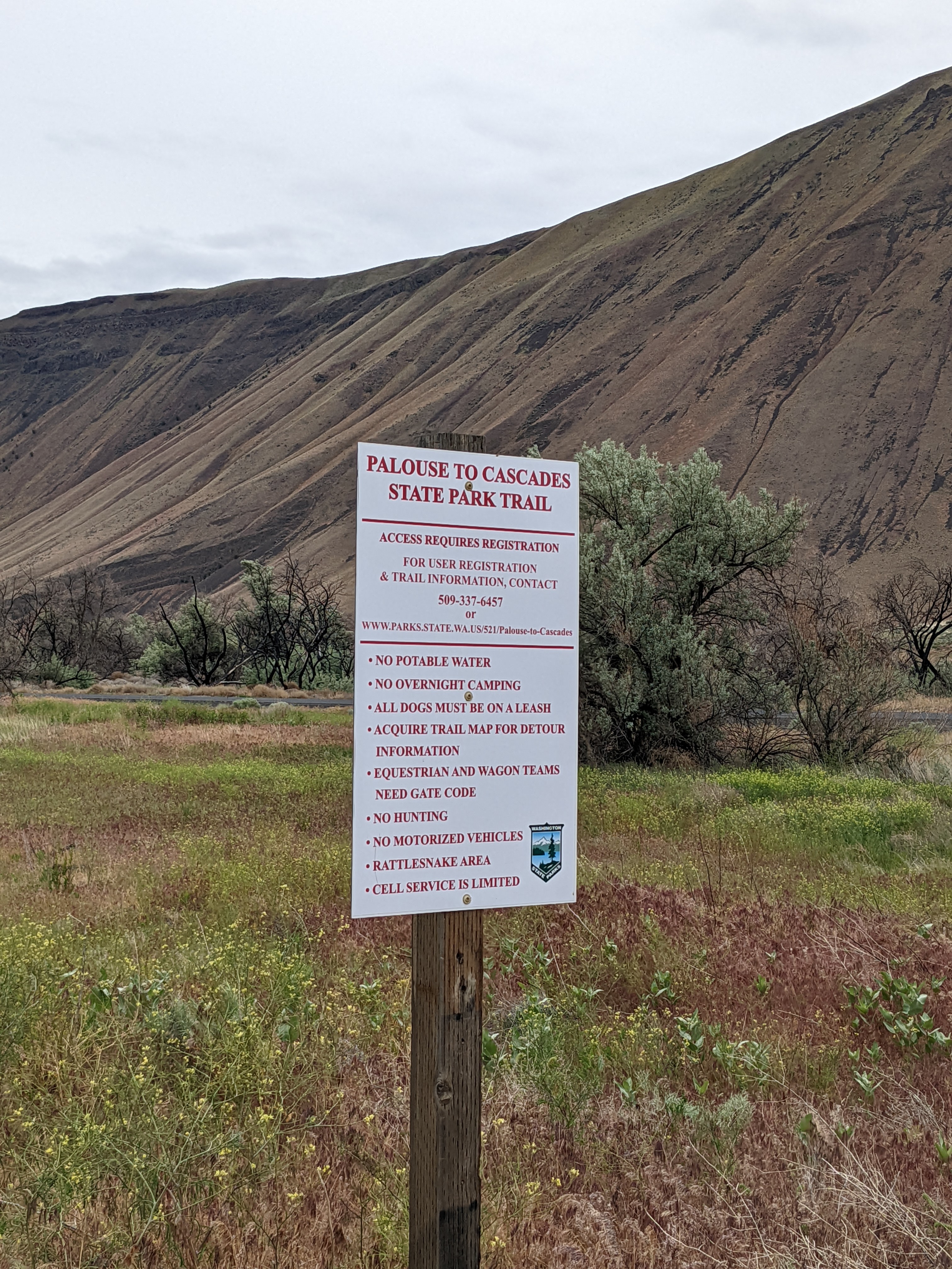
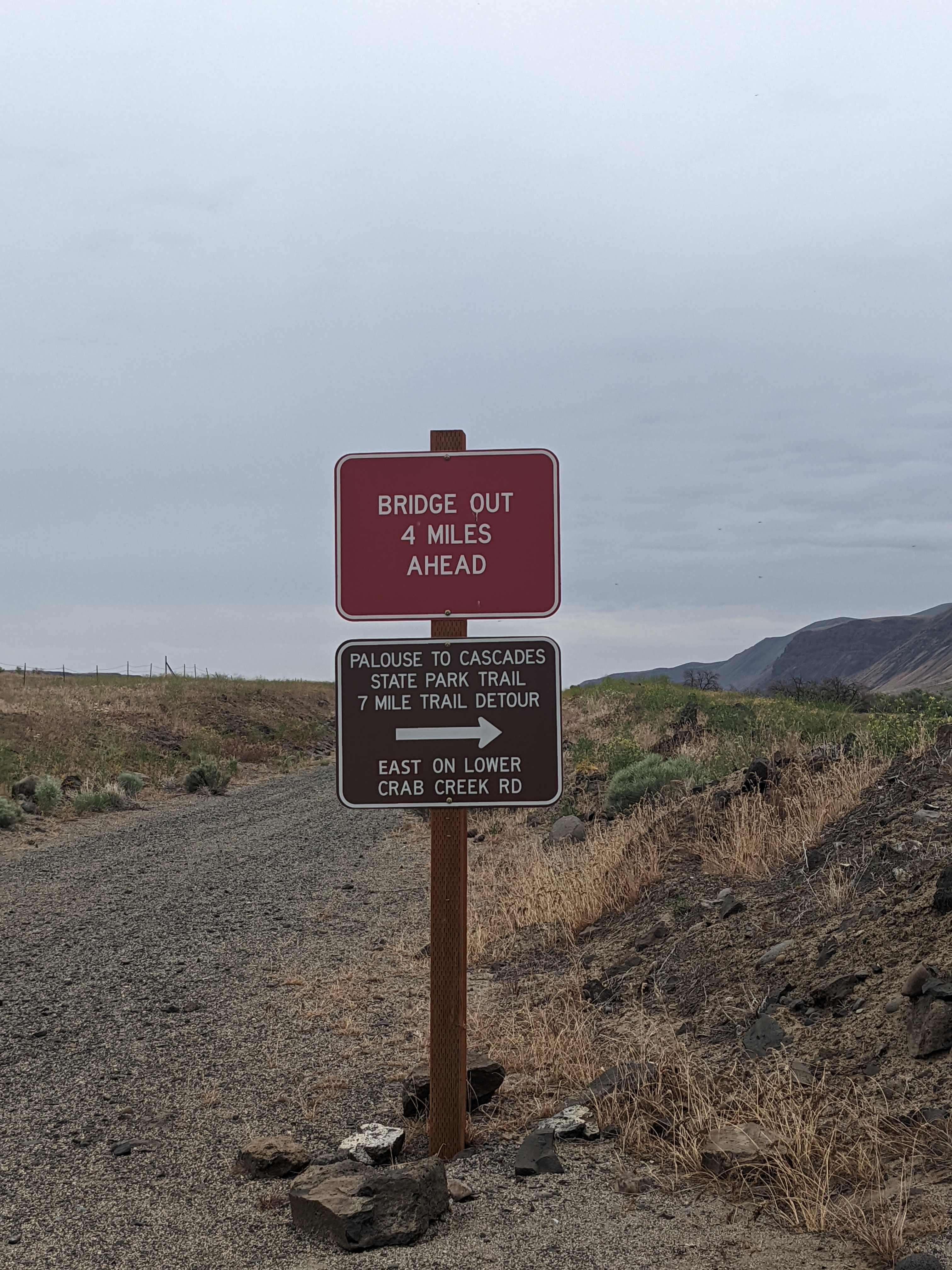
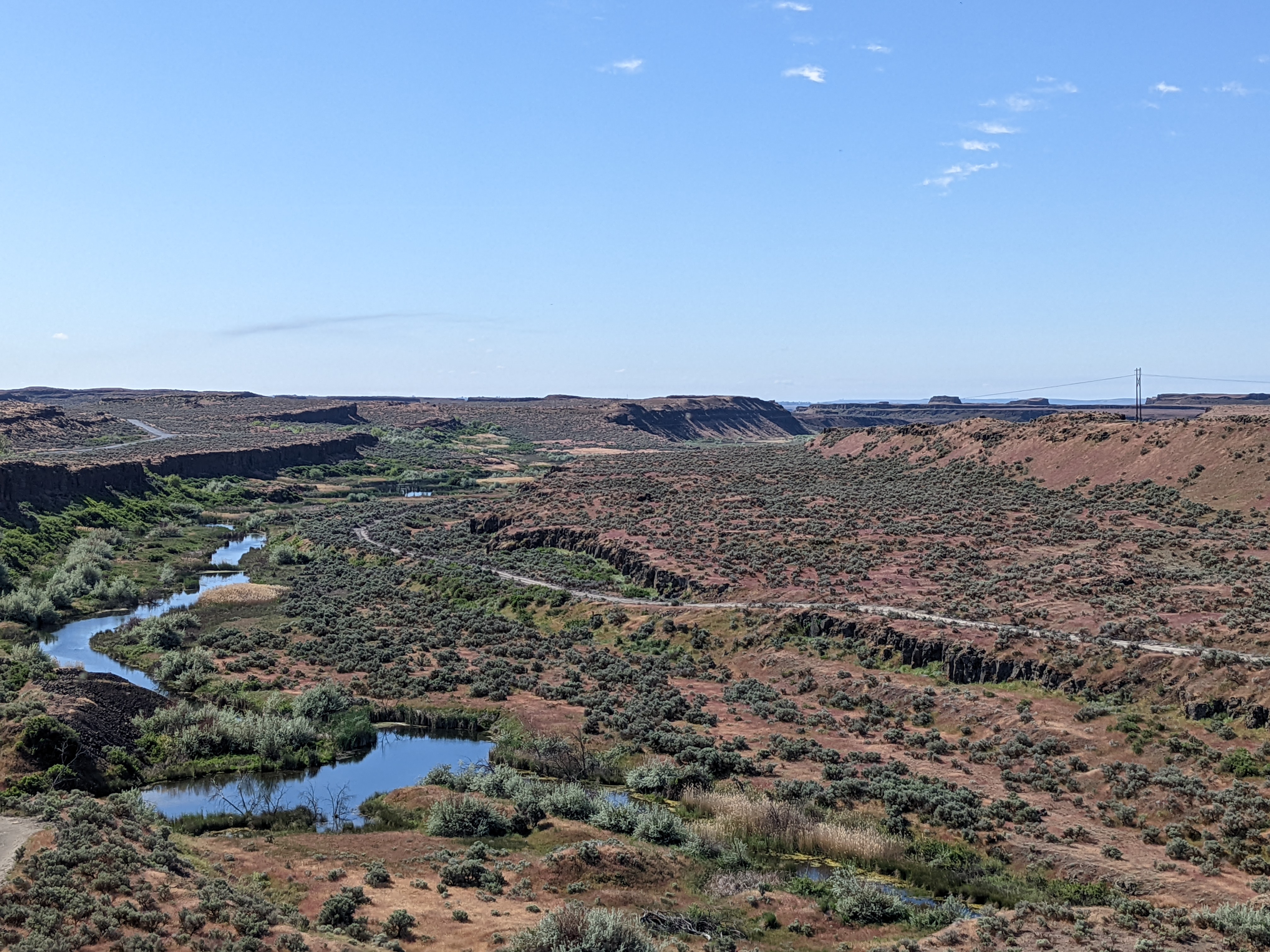
The bridge marks the beginning of the eastern half of the trail, which is far less developed than the western half. Lots of missing sections and detours from here on out.
From temperate rain forests to this.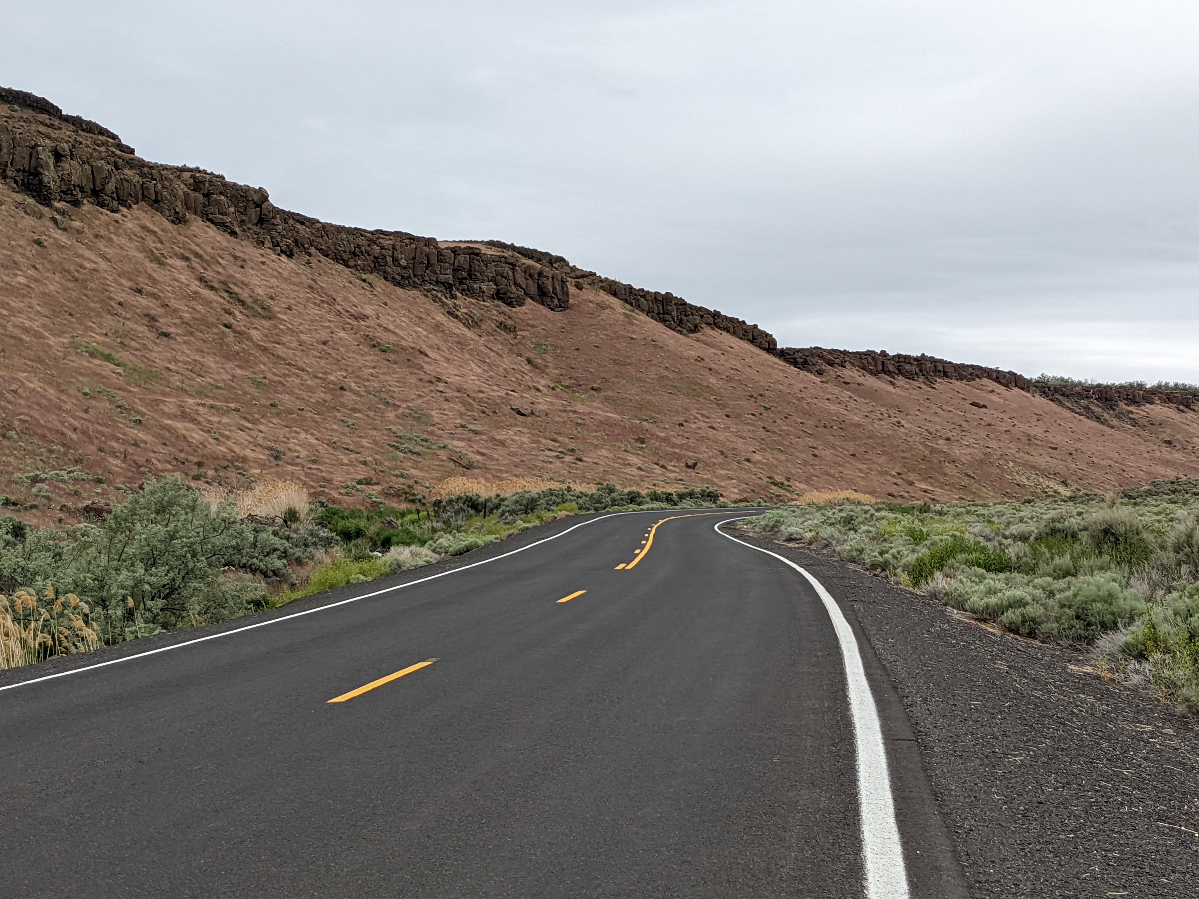
This section of rail is still in use. So it was highways for the next day.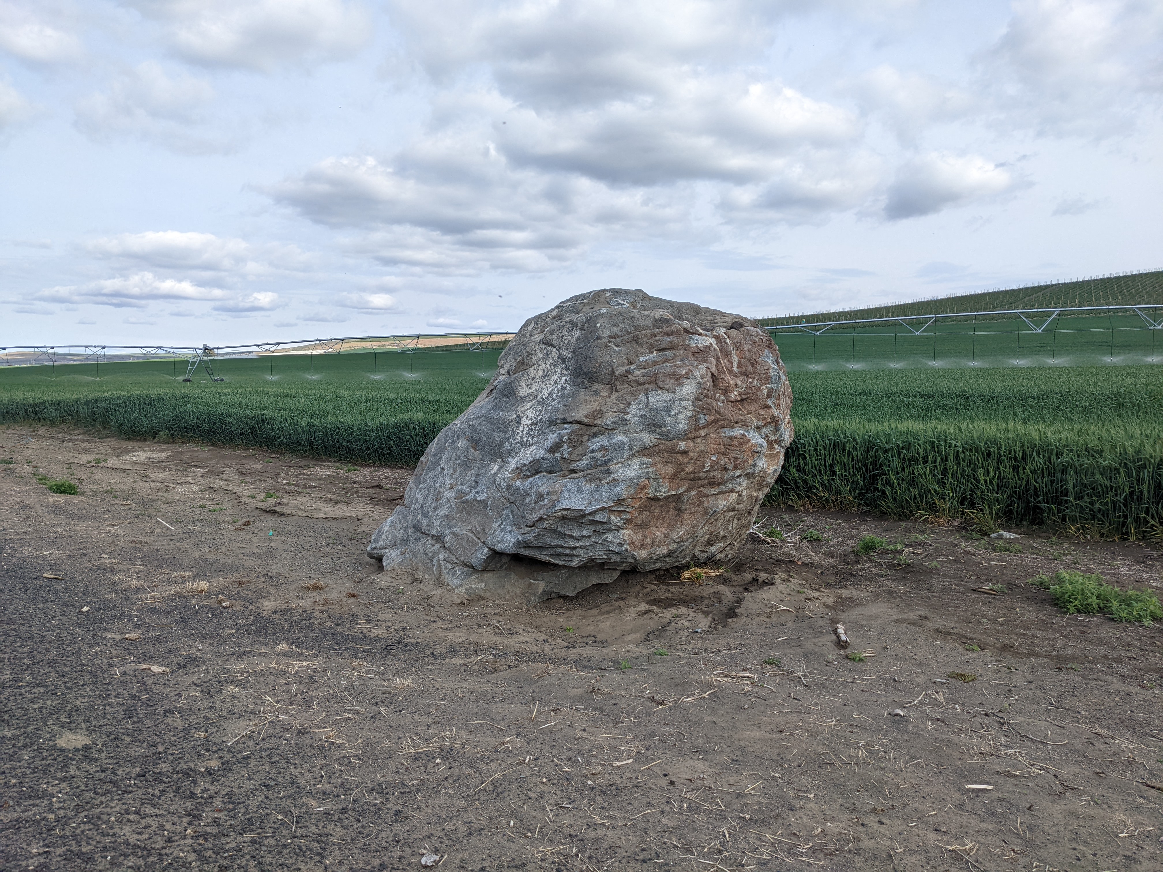
Wait, if the bedrock is basalt for several dozen miles in every direction, and the glaciers never got this far south, how did this boulder get here?
It floated in on a goddamned iceberg, that's how.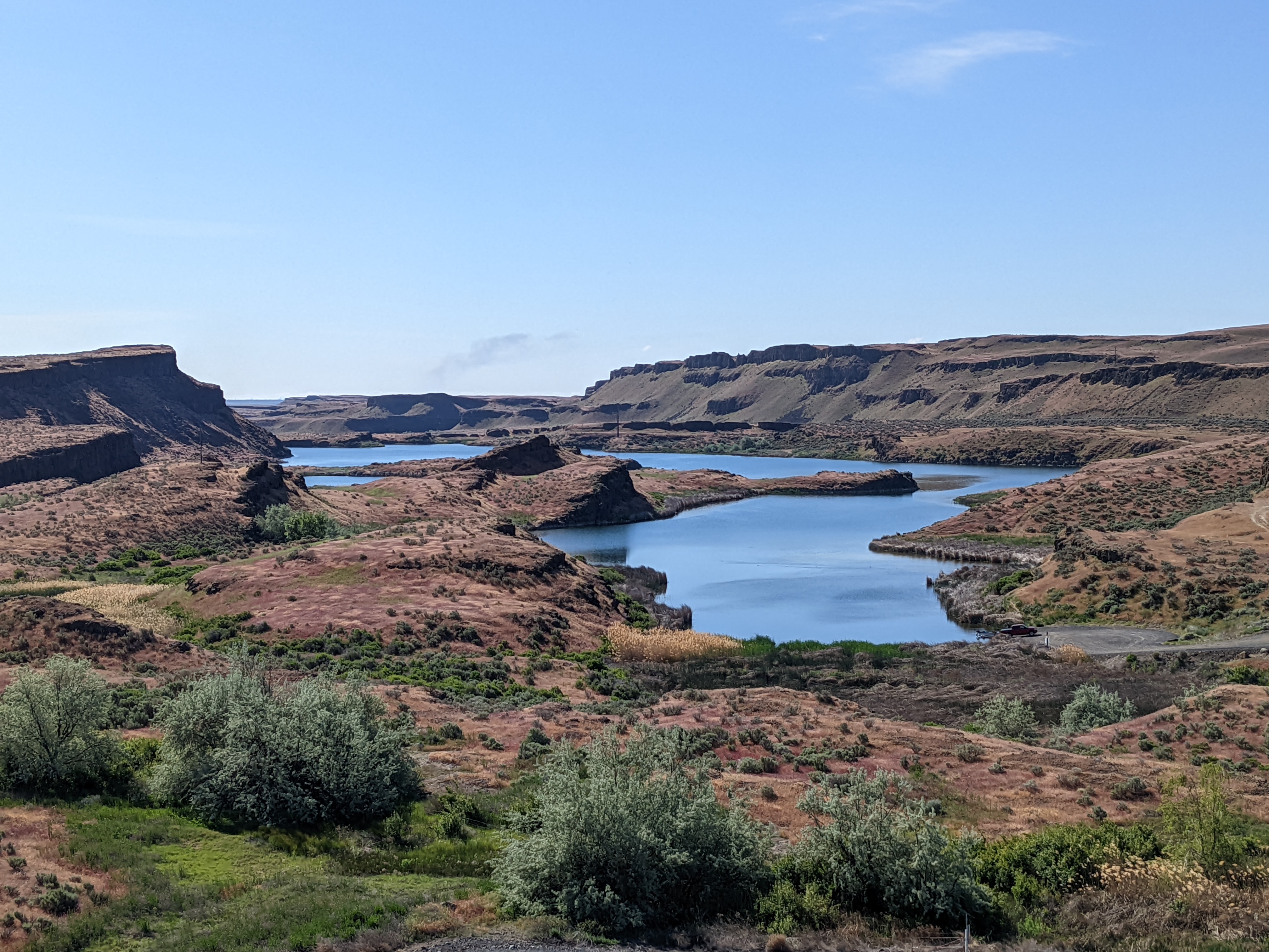
This is the Channeled Scabland (looking unusually green after a very long and wet spring). 15,000 years ago, a series of catastrophic ice age floods ripped through here, tearing up the soil and bedrock and creating some very distinctive landscapes. In the process they dropped thousands of erratics, some tumbled along in the flow, some floating in broken-off bits of glacier. These are found even in areas that didn't get torn up, where temporary lakes formed as the flow got backed up behind various constrictions. The neat thing is that if you look at them plotted on a map, you can plainly see how high that lake got. The erratics just stop at a specific altitude, like the dirty ring on a bathtub.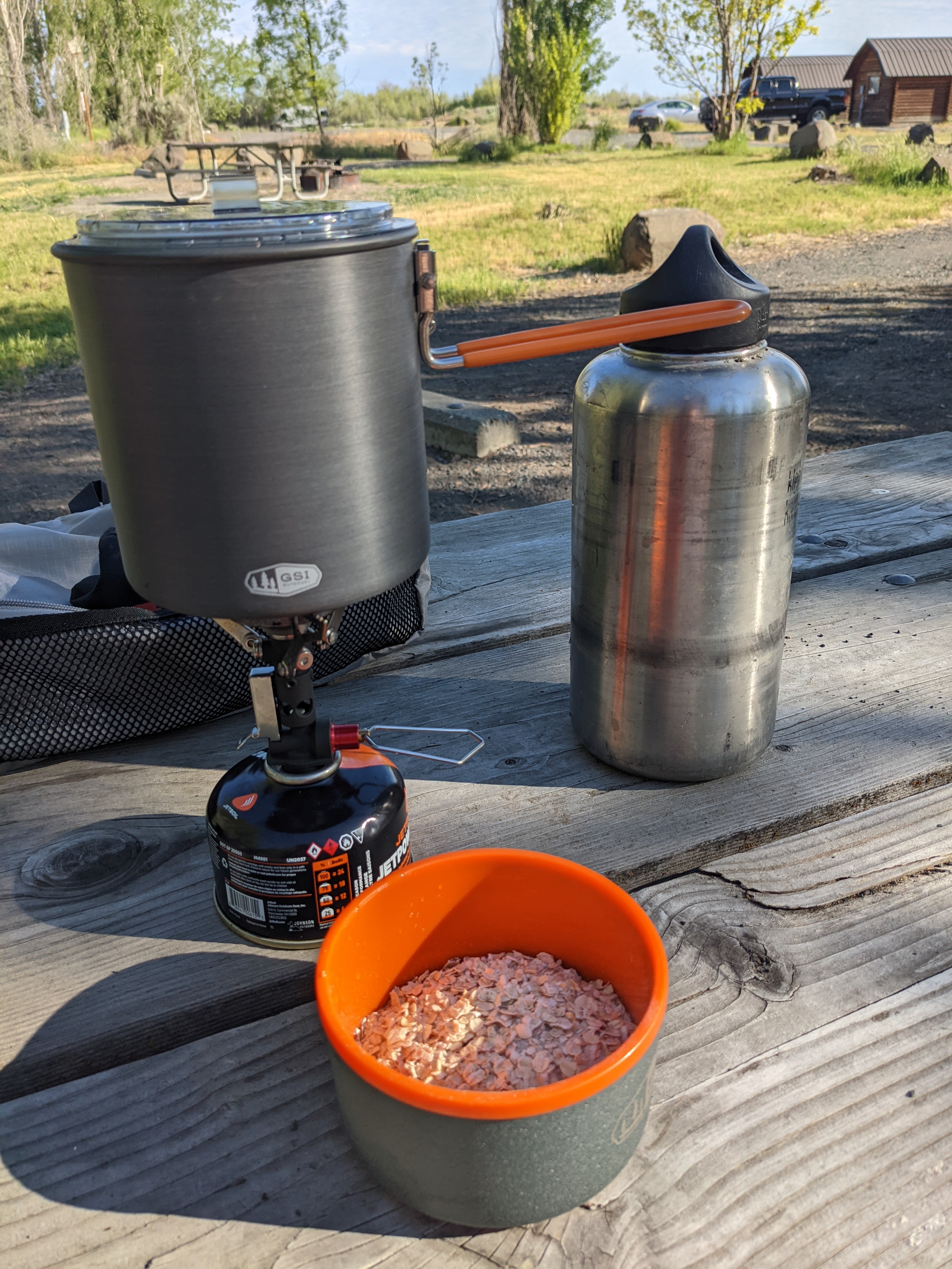
Having grown up on 1970s camping equipment, these modern burners are just amazing. They weight next to nothing and put out an astonishing amount of heat.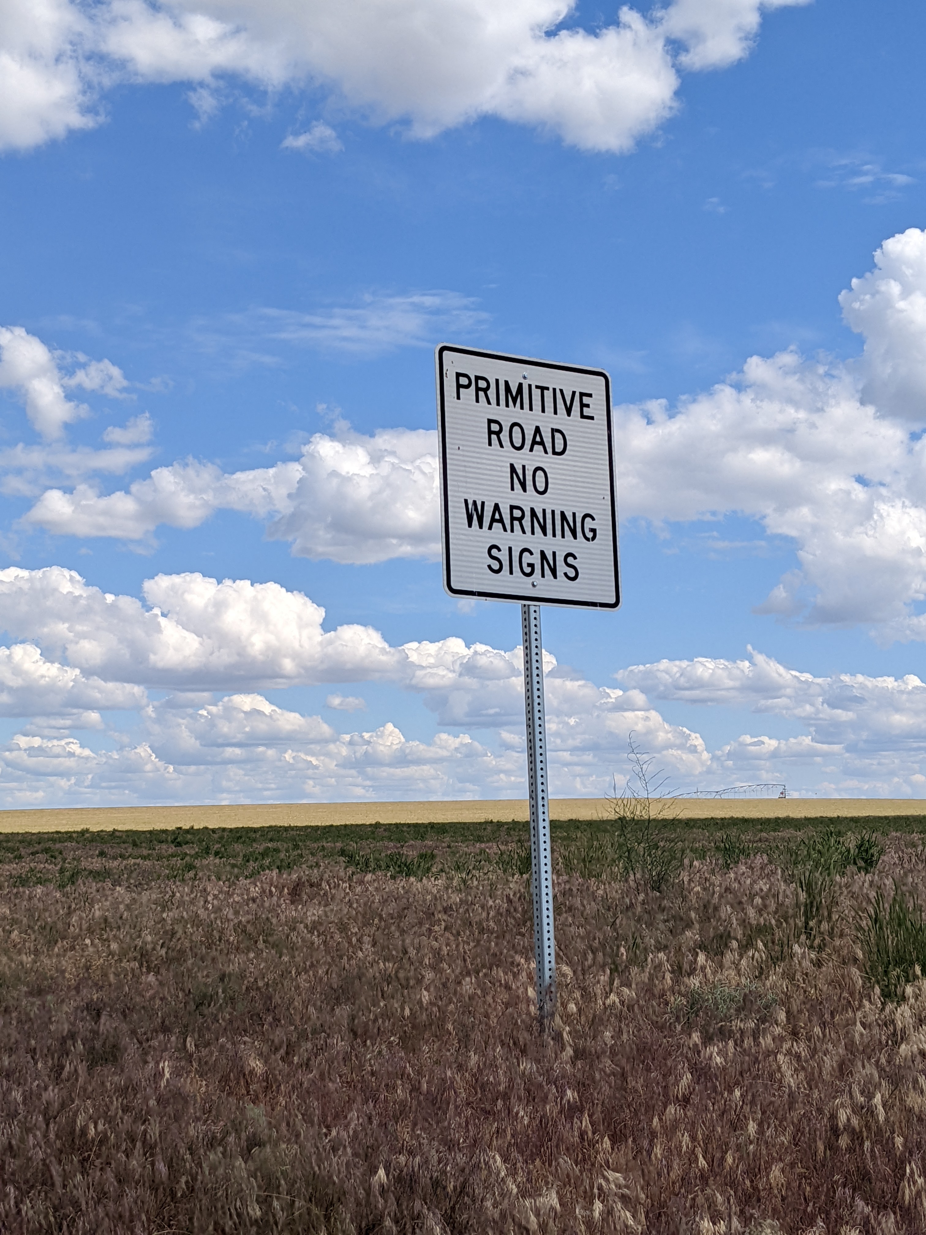
My rear rack started to fail again, so I had to change my plan and make a detour up to Moses Lake to hit the Last Homely HouseBike Shop for a replacement. That went well enough, but then I had another 70 km to go to get to Ritzville for the night, which a couple wrong turns didn't help with. It was definitely the hardest day of the trip.
Ice halos as I enter the Palouse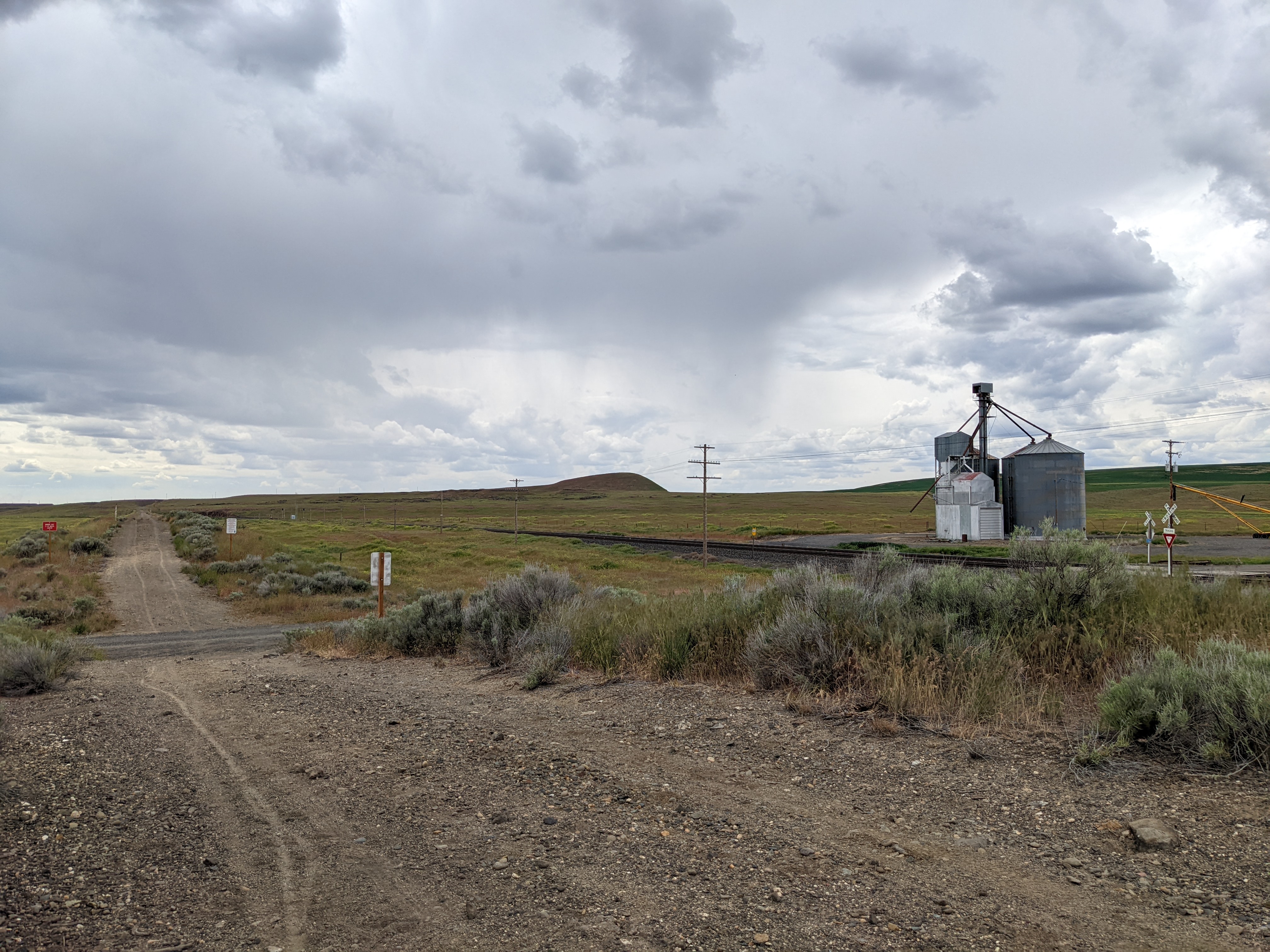
I finally got back to the trail, but it was slow going. The surface is poorly compressed gravel for long stretches, making it very hard going, particularly on a recumbent.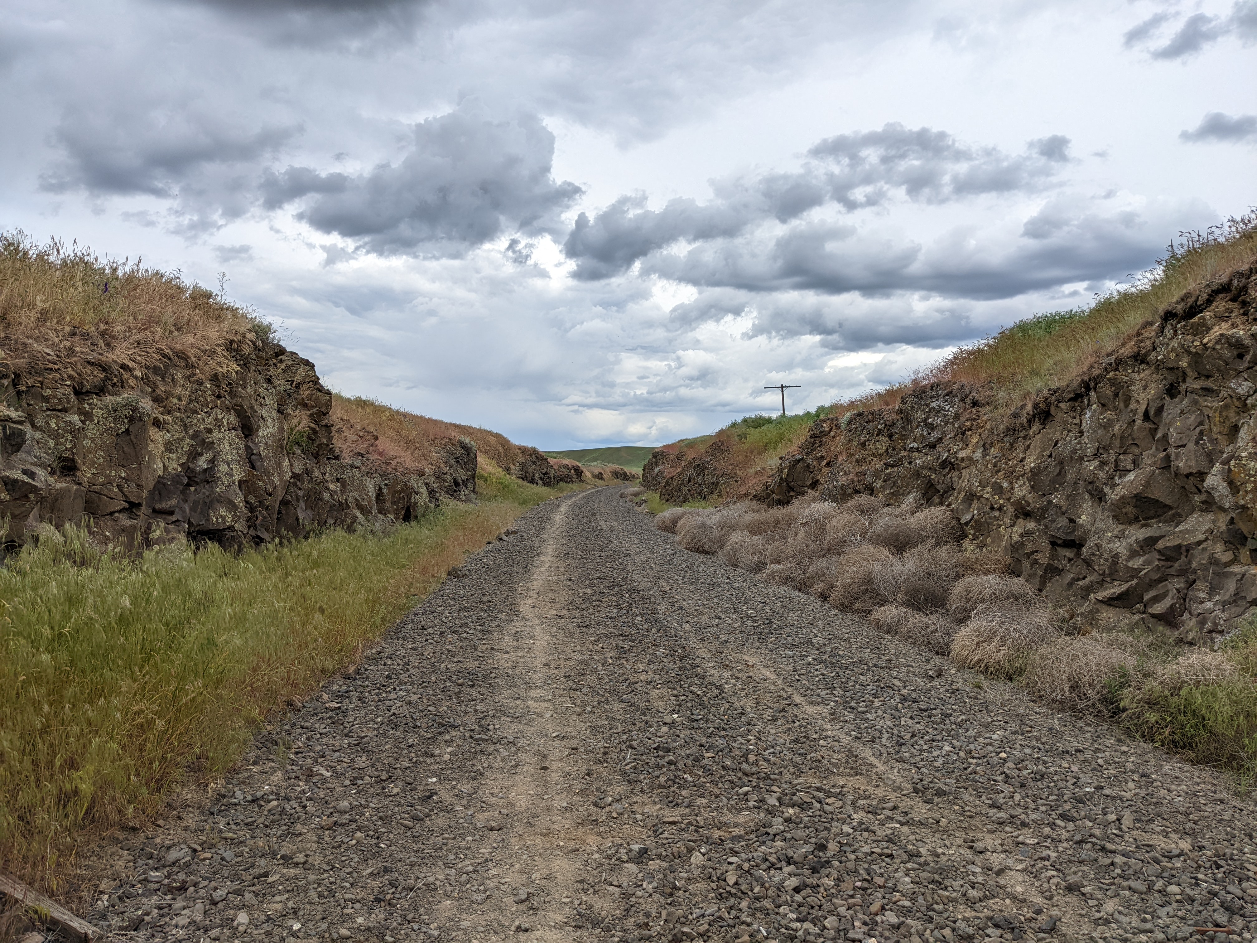
Magnificent desolation, really going into the middle of nowhere here. For the first time on the trip, cell coverage because spotty. Not far from here a rattlesnake let me know I should keep my distance.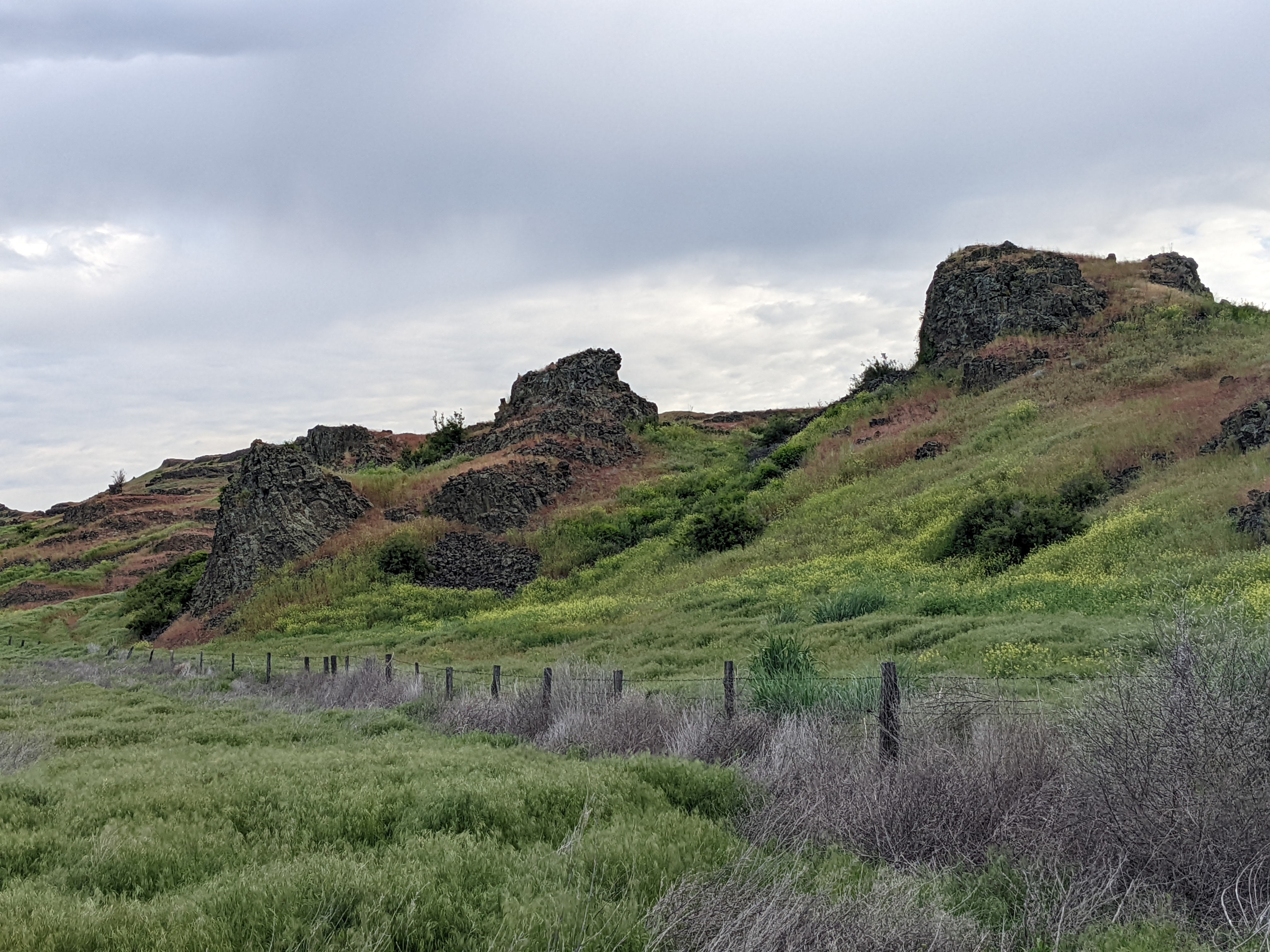
I biked a couple km south of the trail to camp on the Escure Ranch BLM land. It has the remains of the feeder dikes for one of the last basalt flood events. I was greeted by a group of cowboys when I got there, who had just finished branding 300 calves. After getting some amicable shit for being from Seattle, I was invited over for a beer.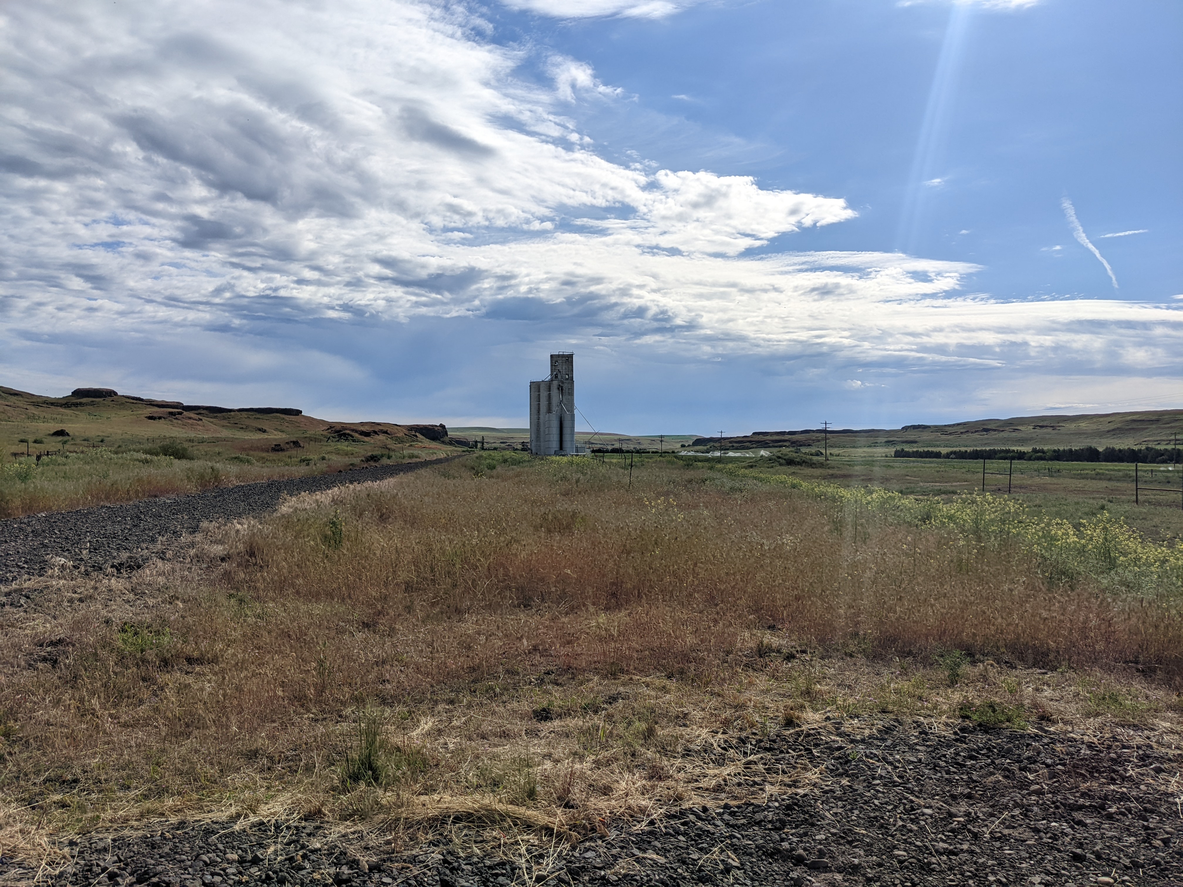
Back on the trail the next day, more deep gravel, then another lengthy detour around the Rock Lake segment.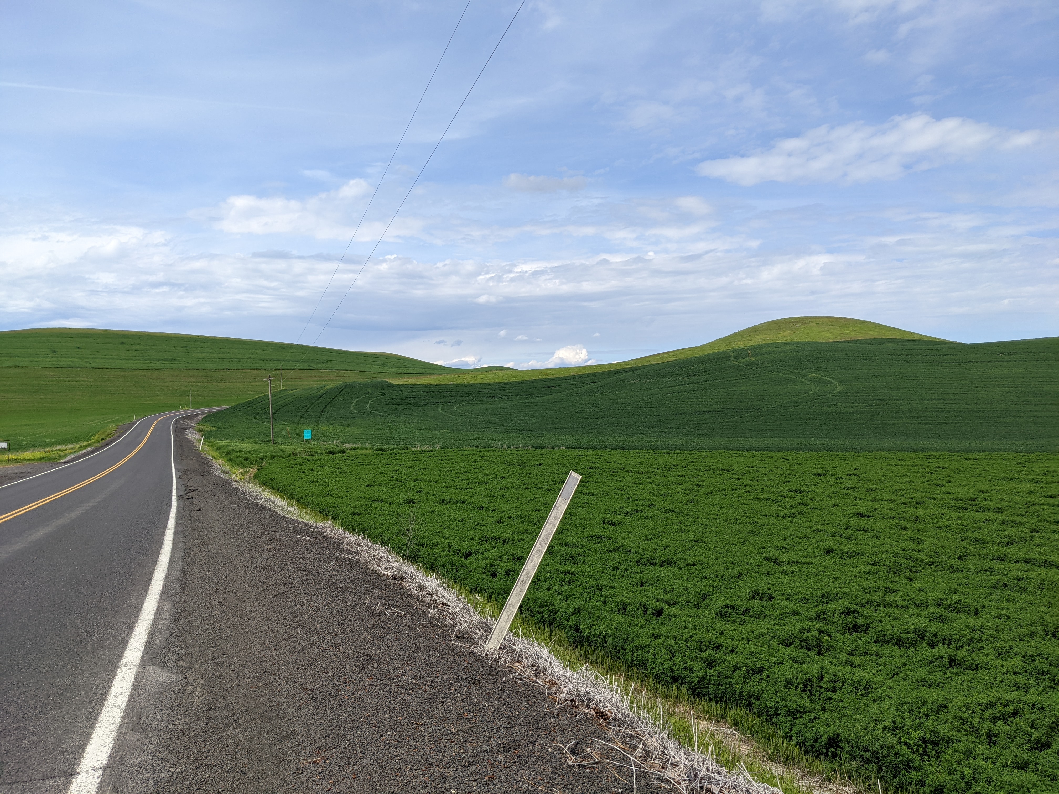
I had finally arrived at the Windows 95 wallpaper. This is pure Palouse -- a hundred mills of rolling hills covered in wheat fields.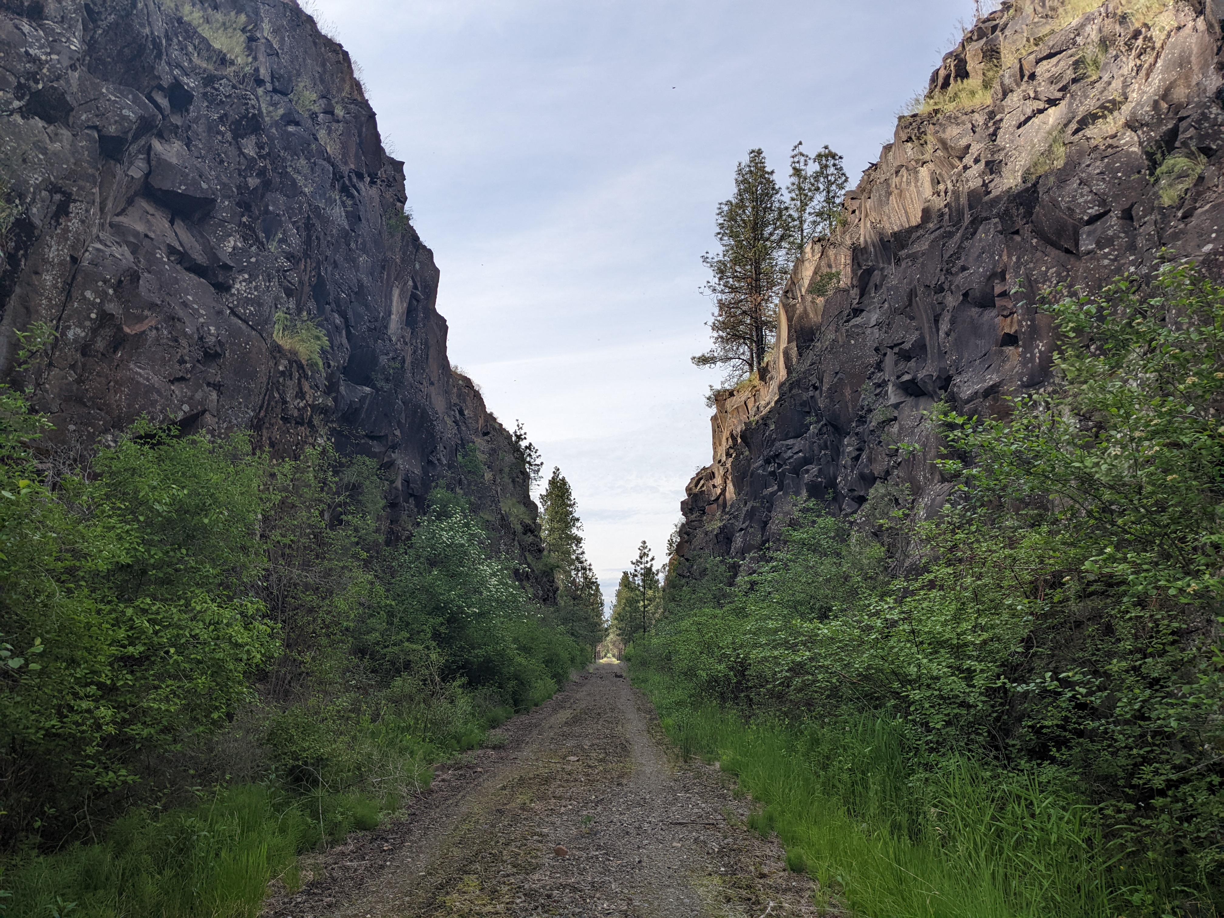
The trail conditions continued to deteriorate. The dirt made for better riding than the thick gravel, but it would only take one good rain to turn it into impassable mud.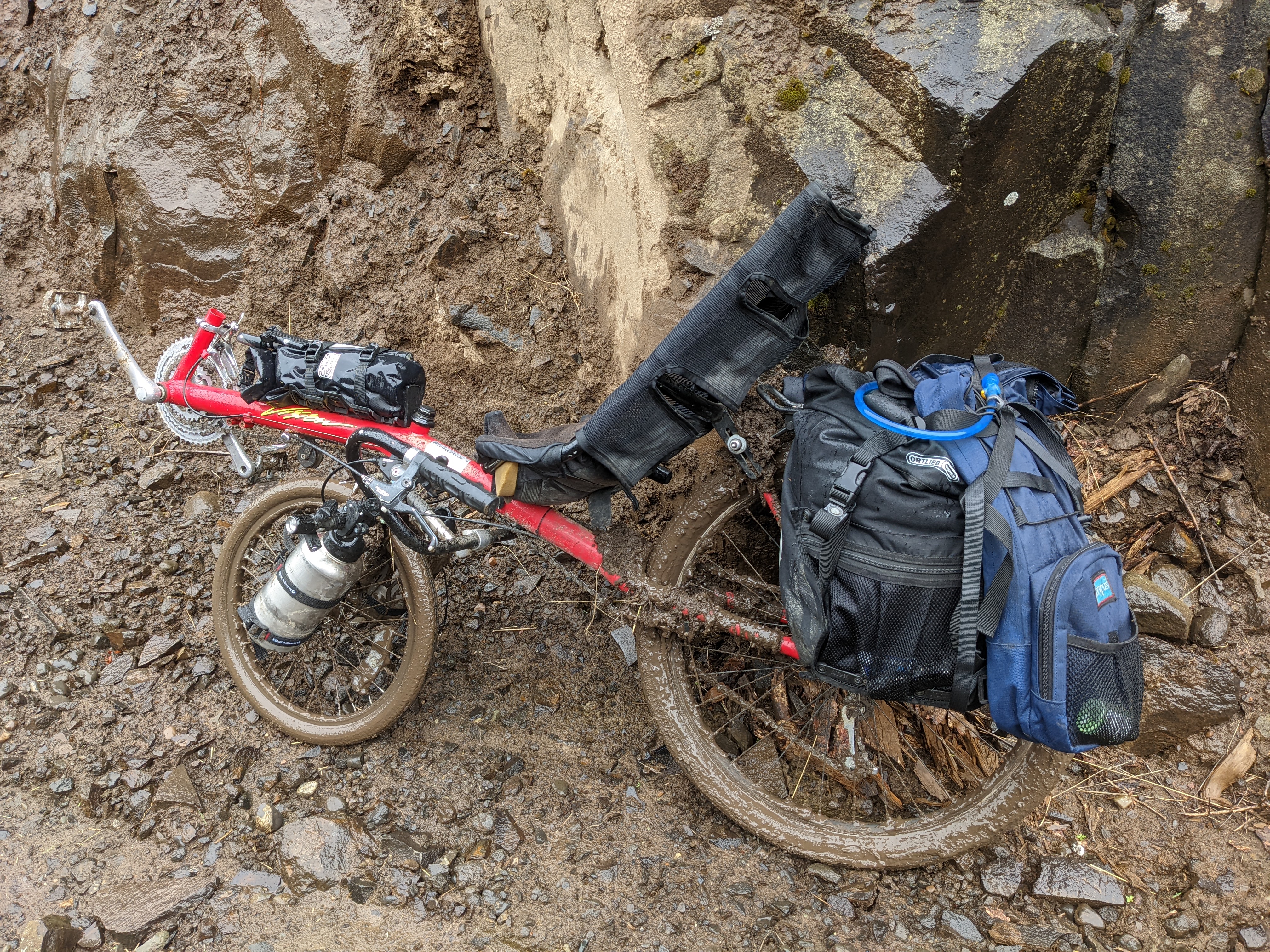
Guess what happened the next day?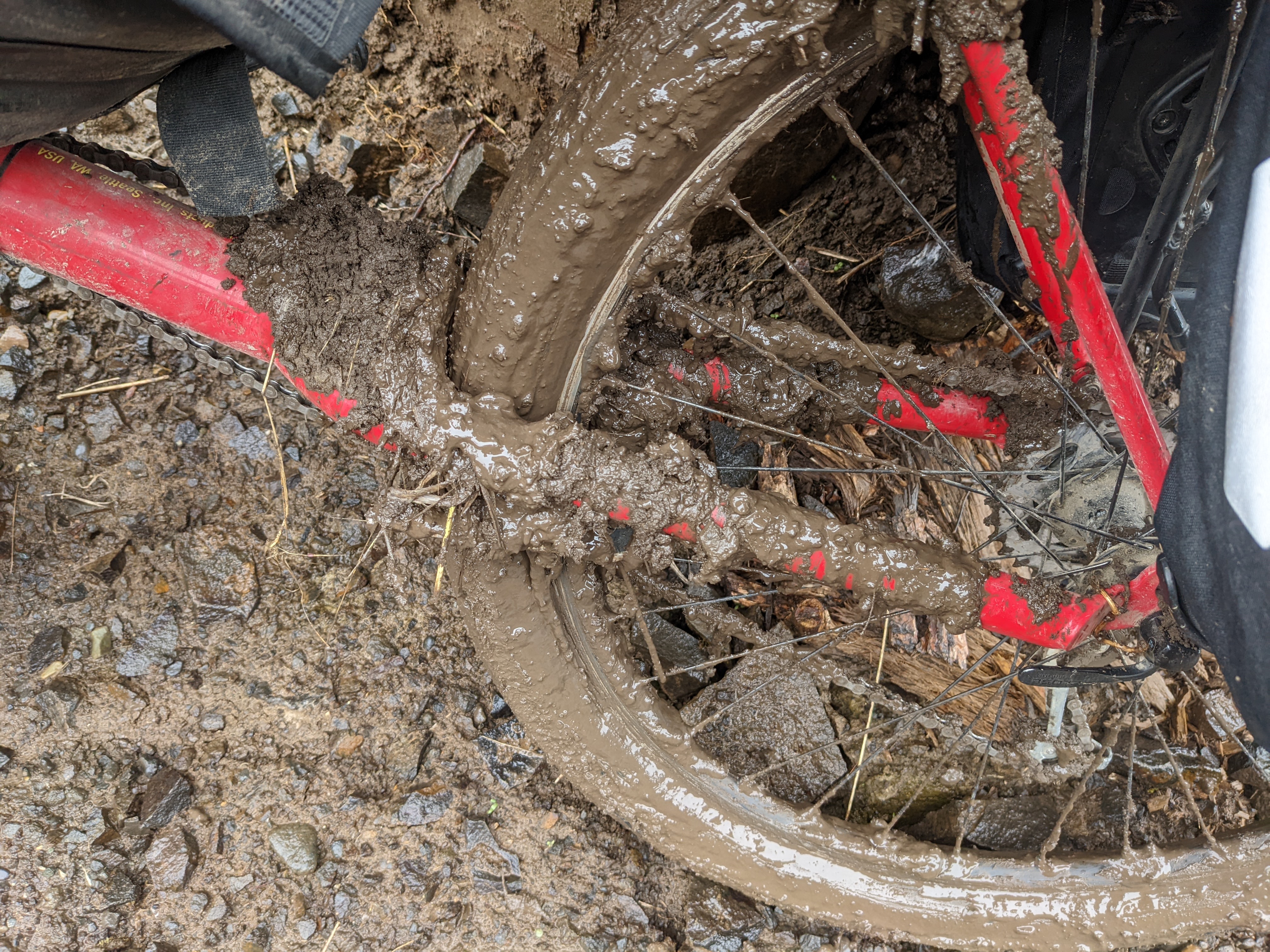
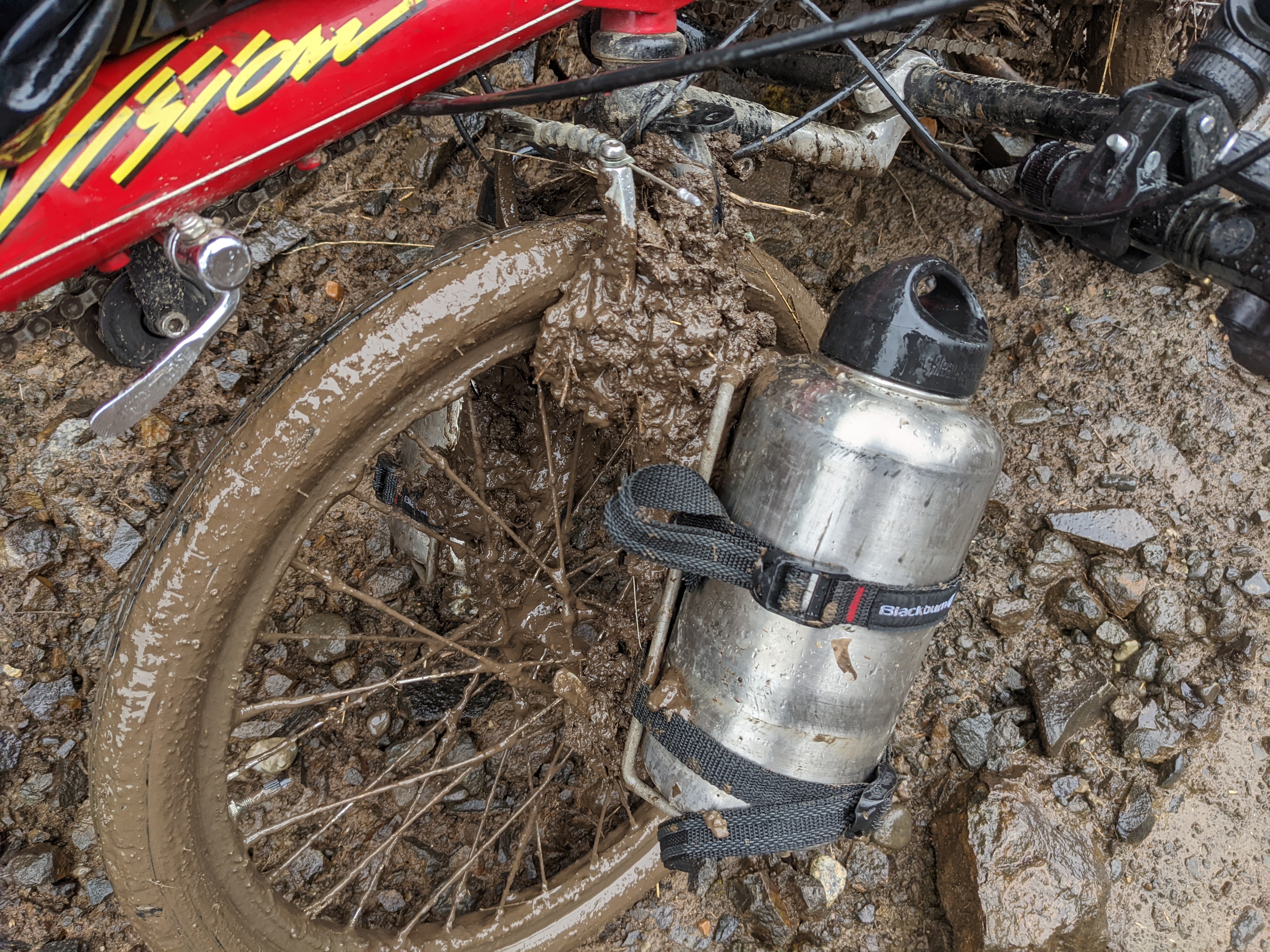
It got much worse than this, actually, but by that point I was so soaked and filthy I didn't want to use my phone. The rear sprockets got so packed with mud that it couldn't stay in a single gear, constantly on a random walk between first and third, derailing every other minute. I was left pushing it out on farm roads, and my vacation time was up.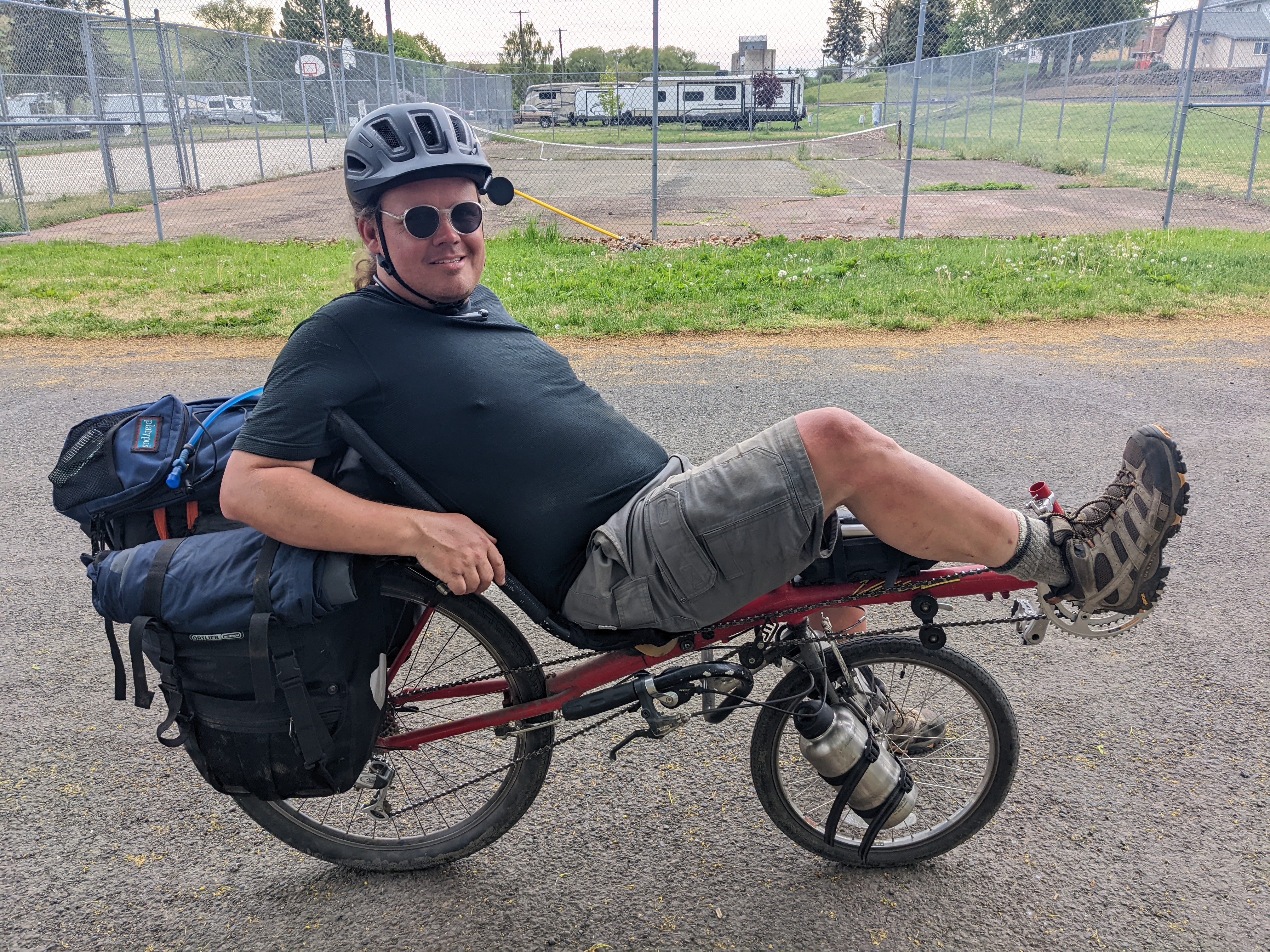
So I didn't quite finish the trail all the way to Idaho, but I definitely biked across the state. That's good enough, I think. Time to make a kayak and paddle up the Salish Sea, maybe!
no subject
no subject
no subject